Itsenäisyydentien kohteet
Itsenäisyydentien varrelle sijoittuvat eri aikakausien linnoitteet, rakennukset ja muistomerkit. Jokaisesta esittelykohteesta on oma sivu, josta löytyy taustatietoja sekä linkit kohteen sijainnille maastossa ja ajo-ohjeisiin. Ne auttavat kohteiden löytämisessä, koska kaikille ei ole opastusta päätien varresta. Lisäksi on linkkejä kohteen omille kotisivuille tai muihin tietolähteisiin.
Historiallisten kohteiden lisäksi on esitelty infopisteet.
Attractions on the Itsenäisyydentie road
Along the Itsenäisyydentie road there are fortresses, buildings and monuments from different eras. Each demonstration site has its own page with background information and links to locations and driving directions. They will help you find your destinations as there is no guidance along the main road for every attraction. There are also links to the attractions' own websites or other sources of information.
In addition to historical attractions, information points and their locations are introduced.
- Paikka maastokartalla/The place on a terrain map
- Google maps ajo-ohjeet/Google maps driving directions
In English below.
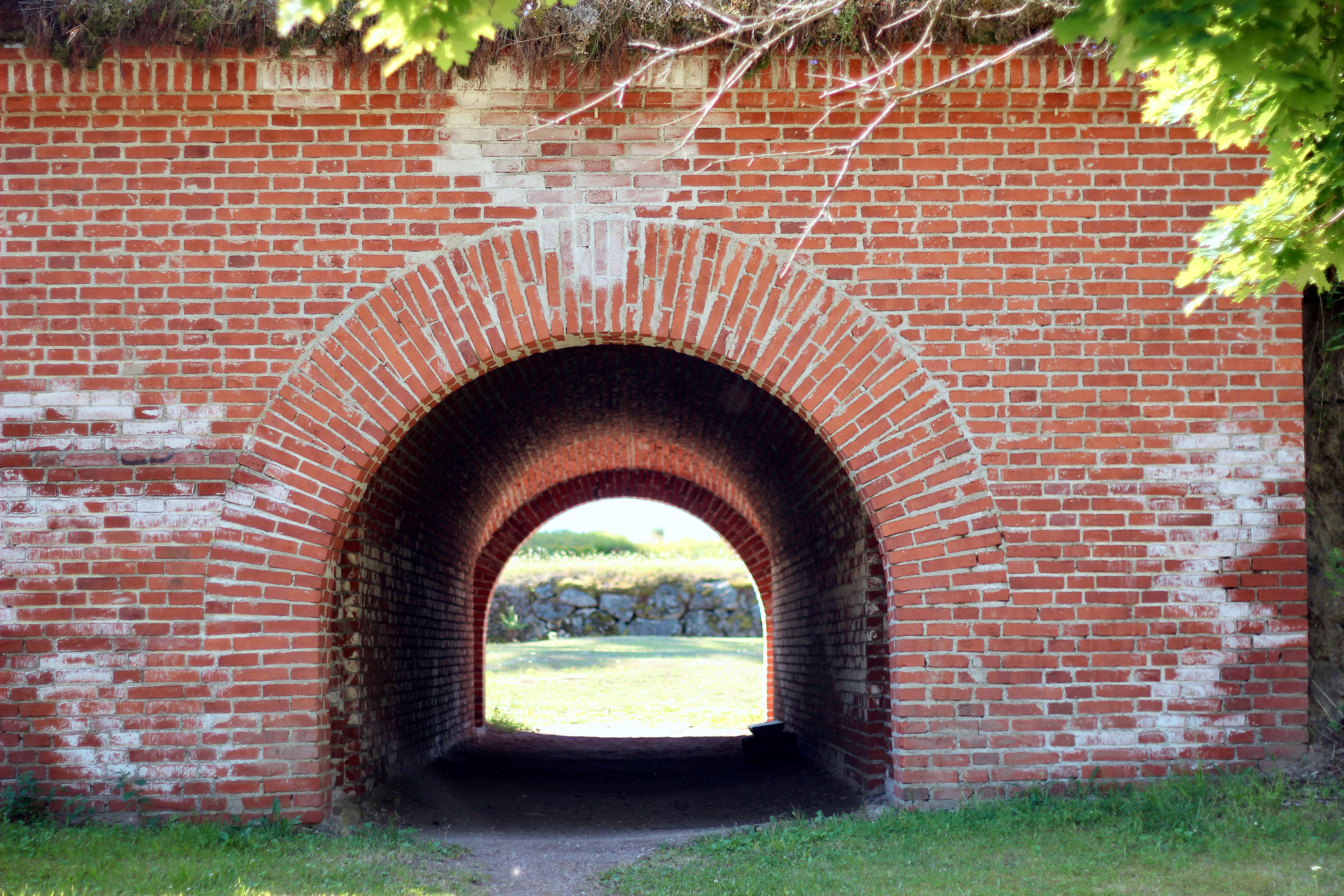
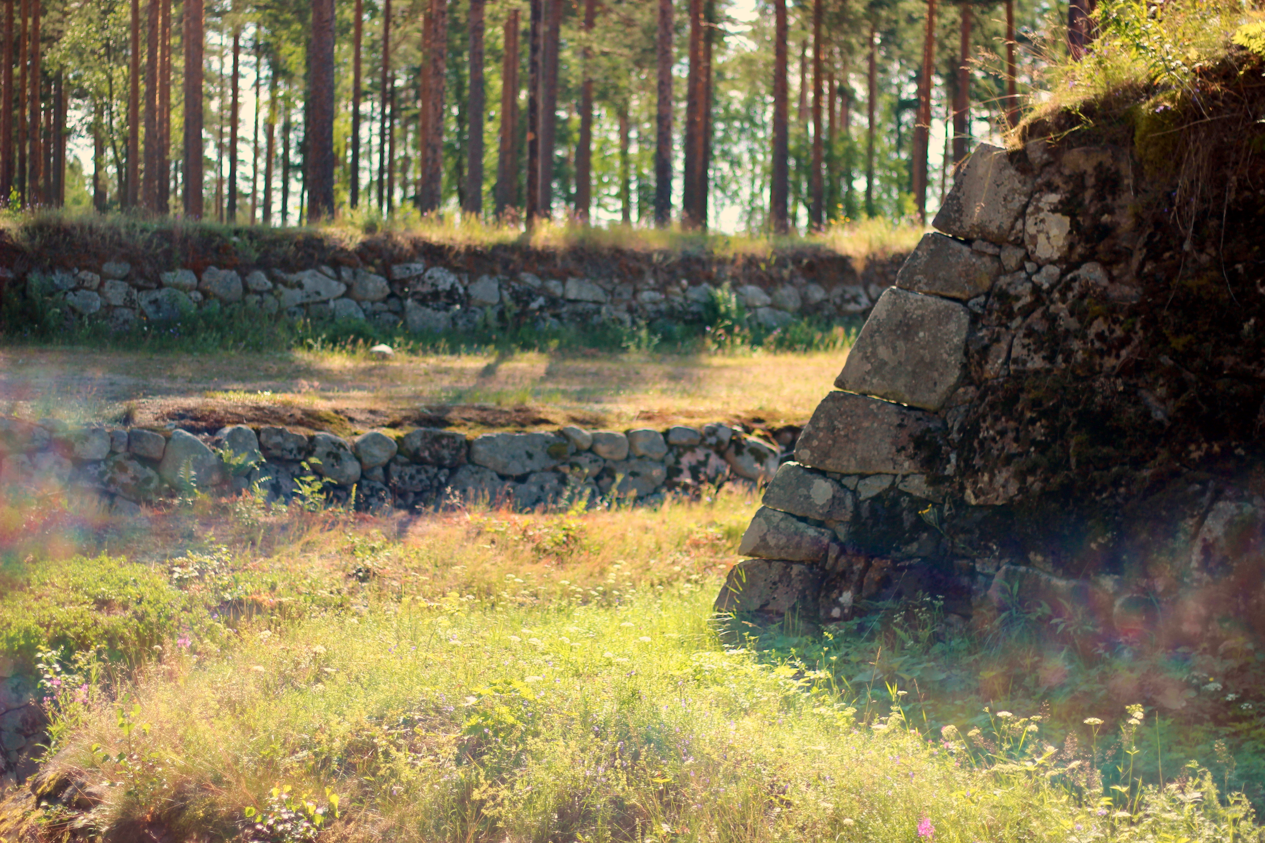
Taavetin linnoitus on 1700-luvun loppupuolen bastionilinnoitus ja se edustaa varhaisinta vaihetta Luumäen linnoittamisessa. Taavetin linnoituksen rakentaminen aloitettiin 1770-luvulla. Neljän tien risteyksessä oleva Marttilan kylä katsottiin strategisesti tärkeäksi paikaksi linnoittaa. Täällä kohtasivat Hämeenlinnasta Viipurin johtava Ylinen Viipurintie sekä Haminasta sisämaahan johtava tie. Linnoitus rakentamisesta päätettiin pyhimys David Tessalonikalaisen muistopäivänä ja se nimettiin hänen mukaansa.
Ensin aloitettiin ulomman linnoituksen rakentaminen, sen koko oli noin 800 x 650 metriä. Sitä ei ehditty saada täysin valmiiksi. Linnoituksen toinen rakennusvaihe tapahtui 1790-luvulla, kun kenraali Suvorovin toimesta rakennettiin Pietaria turvaavat linnoitusketjut. Taavetti muodosti Haminan ja Lappeenrannan kanssa keskimmäisen puolustuslinjan. Toisessa vaiheessa rakennettiin varsinainen sisälinnoitus ja vahvistettiin ulompaa linnoitusta. Alueelle rakentui pieni linnoituskaupunki, jossa oli kymmeniä puu- ja kivirakennuksia ja sinne majoittui tuhansia sotilaita. Heitä varten rakennettiin myös oma ortodoksinen kirkko, ensin puinen ja myöhemmin tiilinen. Kirkon kivijalasta on osa jäljellä kunnantalon pääoven tuntumassa. Linnoituksen toiminta-aika jäi lyhyeksi ja se lakkautettiin heti Suomen sodan jälkeen vuonna 1809.
Idempänä noin 10 km päässä Itsenäisyydentien varrella on Kairlammen läheisyydessä maastossa 1700-luvun vartiolinnakkeen jäänteitä. Linnake on rakennettu tien molemmin puolin mäen rinteeseen ja rintama suunta on ollut länteen päin. Tien eteläpuolella on maastossa edelleen havaittavissa kaivantoja. Linnake on mahdollisesti tehty Taavetin linnoituksen rakentamista yhteydessä tai aiemmin. Kivijärven eteläpuolinen tieyhteys koettiin jo silloin tarpeelliseksi linnoittaa.
Linnoitus eli hiljaiseloa, kunnes 1890-luvulla sen alueella harjoitteli kesäisin Mikkelin tarkka-ampujapataljoonaan kuuluva reservikomppania. Sitä varten linnoitusalueen sisälle rakennettiin ampumarata ja useita rakennuksia, joista jäljellä ovat punainen tupa sisäänkäynnin vieressä ja museorakennus sisälinnoituksen itäpuolella. Luumäen kunta osti linnoitusalueen rakennuksineen vuonna 1922 valtiolta ja Taavetin taajama on rakentunut osin sen sisälle. Linnoitusta alettiin kartoittaa pikku hiljaa 1960-luvun lopulta lähtien ja ensimmäisiä restaurointitöitä tehtiin 1980-luvulla. Kokonaisuudessaan ulko- ja sisälinnoitus inventointiin vasta 2000-luvun alussa. Sisälinnoitusta ja pohjoislaidan bastioneja on restauroitu Museoviraston toimesta.
Linnoitukseen voi tutustua omatoimisesti joko opastustaulujen viitoittamalla kierroksella, frisbeegolf-rataa kiertäen tai vaikka viettämällä eväshetken. Myös pururata kiertää linnoituksen kautta. Kesäisin linnoituksessa järjestetään tapahtumia ja lauluiltoja. Tunnetuimmat tapahtumat ovat Vallijamit ja Marttilan kylän markkinat. Kesäisin on lisäksi opastuskierroksia. Linnoituksen vieressä on linnoitus- ja kotiseutumuseo, punainen tupa ja kunnantalo sekä muistomerkkejä.
Taavetin linnoitukseen on opastus VT6:lta ja Hamina-Savitaipale-tieltä. Pysäköinti ja käynti sisälinnoitukseen on kunnantalon länsipuolelta.
Lisätietoja museosta ks. linnoitus- ja kotiseutumuseo
Lisätietoja kenraali Suvorovista löytyy mm. Etelä-Karjalan museon Suvorov-verkkonäyttelystä.
Taavetti fortress
The fortress in the centre of Taavetti is part of the chain of fortresses built during the period of Russian rule in the late 18th century to protect St. Petersburg. The village of Marttila, at the intersection of four roads, was considered a strategically important place to fortify. Here, the Ylinen Viipurintie road leading from Vyborg to Hämeenlinna and the road leading inland from Hamina intersected. The construction of the fortress was decided on the Day of Remembrance of Saint David of Thessalonica and was named after him.
First, construction began on the outer fortress, which was about 800 x 650 meters in size. It was not fully completed. The second phase of the fortification took place in the 1790s, when General Suvorov built the fortification chains that secured St. Petersburg. Taavetti formed the middle line of defense with Hamina and Lappeenranta. In the second phase of construction, the actual inner fortress was built and the outer fortress was strengthened.Taavetti formed the middle line of defense with Hamina and Lappeenranta. In the second phase of construction, the actual inner fortress was built and the outer fortress was strengthened. A small fortified town was built in the area, with dozens of wooden and stone buildings and housing thousands of soldiers. A separate Orthodox church was built for them, first wooden and later brick. Part of the stone footing of the church remains near the main door of the town hall. The period of operation of the fortress was short and it was abolished immediately after the Finnish war in 1809.
To the east, about 10 kilometers along the Itsenäisyydentie road, there are remnants of an 18th-century watchtower in the terrain near Kairlampi. The fort has been built on both sides of the road on a hillside and the front has been facing west. Trenches are still visible in the terrain to the south of the road. The fort may have been made in connection with the construction of the Taavetti fortress or earlier. The road connection to the south of Kivijärvi was already considered necessary to fortify.
The fortress lived a quiet life until, in the 1890s, a reserve company belonging to the Mikkeli sniper battalion practiced in its territory during the summer. To that end, a shooting range and several buildings were built inside the fortress area, the remaining of which is a red hut next to the entrance and a museum building to the east of the inner fortress. The municipality of Luumäki bought the fortress area and its buildings from the state in 1922, and the built-up area of Taavetti has been built partly inside it. Exploration of the fortress began in the late 1960s and the first restoration work was done in the 1980s. In its entirety, the outer and inner fortifications were not inventoried until the early 2000s. The inner fortress and the bastions on the north side have been restored by the National Board of Antiquities.
You can explore the fortress on your own, either by following the signposts, touring the frisbee golf course, or even having a picnic. During the summer, the fortress hosts guided tours. The jogging track also goes through the fortress. During the summer, the fortress hosts events and singing evenings. The most famous events are the music event Vallijamit and the Marttila village market.
There is a guide to the Taavetti fortress from Highway 6 and the Hamina-Savitaipale Road. Parking and the entrance to the inner fortress is on the west side of the town hall.
For more information about the museum, see Fortress and Homeland Museum.
More information about General Suvorov can be found, for example, in the Suvorov online exhibition of the Museum of South Karelia (in Finnish).
- Paikka maastokartalla/The place on a terrain map
- Google maps ajo-ohjeet/Google maps driving directions
In English below.
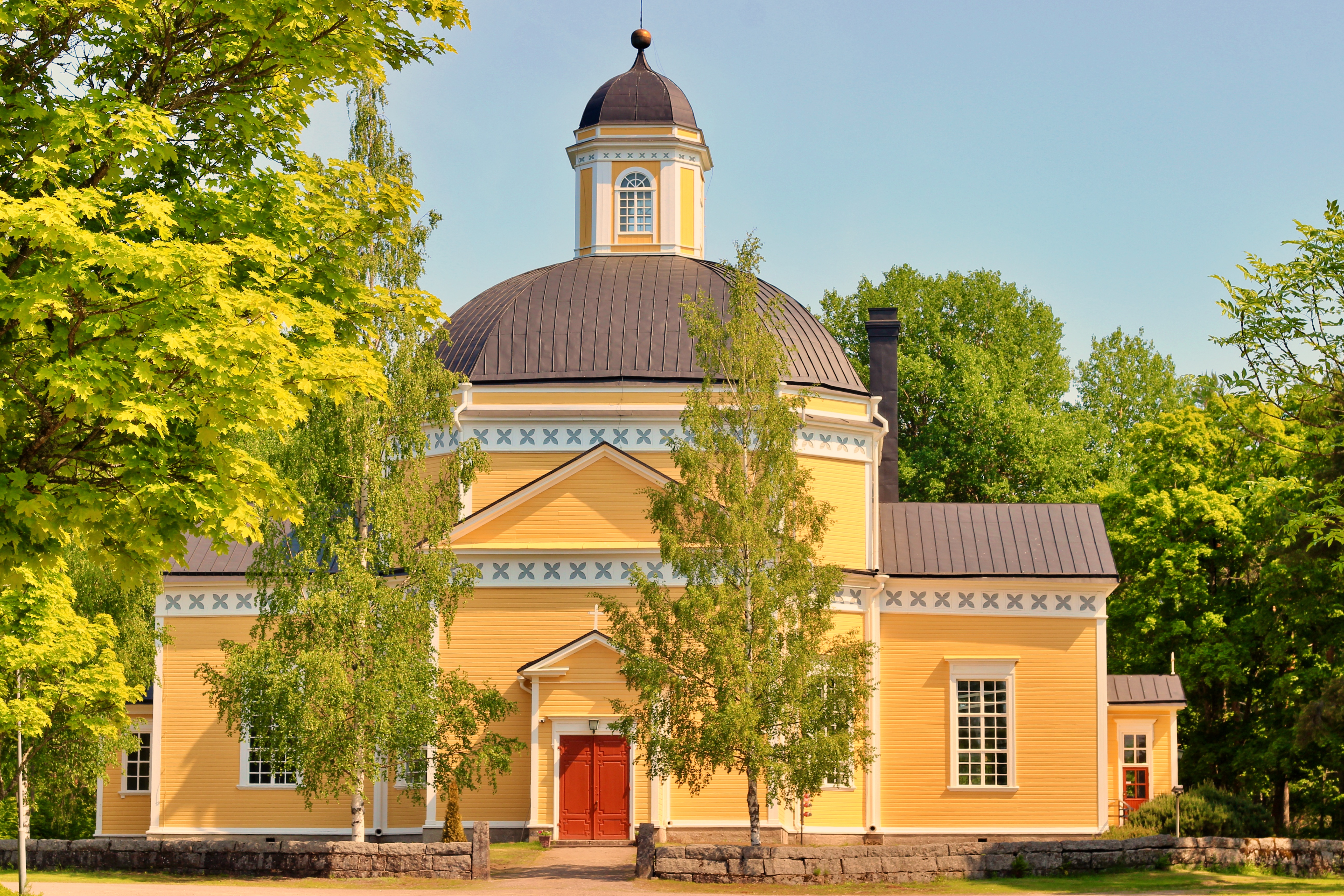
Kirkonmäki hallitsee ympäröivää peltomaisemaa. Pohjoisesta VT6:n suunnasta lähestyttäessä havaitsee ensin hautausmaat mäen rinteessä. Neljän tien risteyksessä on seurakuntatalo ja hieman sivummalla kellotapuli pienen aukion laidalla puinen ristikirkko. Tällä paikalla syntyivät sekä Luumäen seurakunta ja Luumäen pitäjä vuonna 1642, kun Luumäki erosi Lappeen seurakunnasta. Nimi Luumäki viittaa pakanalliseen uhripaikkaan. Tarinat kertovat, että nykyiseltä kirkonmäeltä on löydetty karhun luita ja paikka on ollut tärkeä jo aiemmille sukupolville.
Ensimmäinen kirkko rakennettiin jo kappeliseurakunnan aikana viimeistään 1500-luvun puolivälissä. Seuraava kirkko, Pyhän Marian kirkko, rakennettiin tien toiselle puolelle vuonna 1731 ja samalla hautausmaa siirrettiin sen ympärille. Aiempi hautausmaa unhoittui. Kirkko ja myöhemmin rakennettu kellotapuli tuhoutuivat tulipalossa vuonna 1839. Nykyinen empiretyylinen kirkko valmistui vuonna 1845 C.L. Engelin suunnittelemien mukaan. Kirkko on sisäkulmiltaan viistetty ristikirkko, jonka keskeltä kohoaa suuri kupoli. Istuinpaikkoja siellä on noin tuhat. Vuonna 1913 kirkko peruskorjattiin arkkitehti Ilmari Launiksen suunnitelmien mukaan. Nykyinen alttaritaulu ”Jeesus ristillä” on Martta Helmisen vuonna 1929 maalaama. Aiempi peltinen krusifiksi on nähtävillä Linnoitus- ja kotiseutumuseossa Taavetissa.
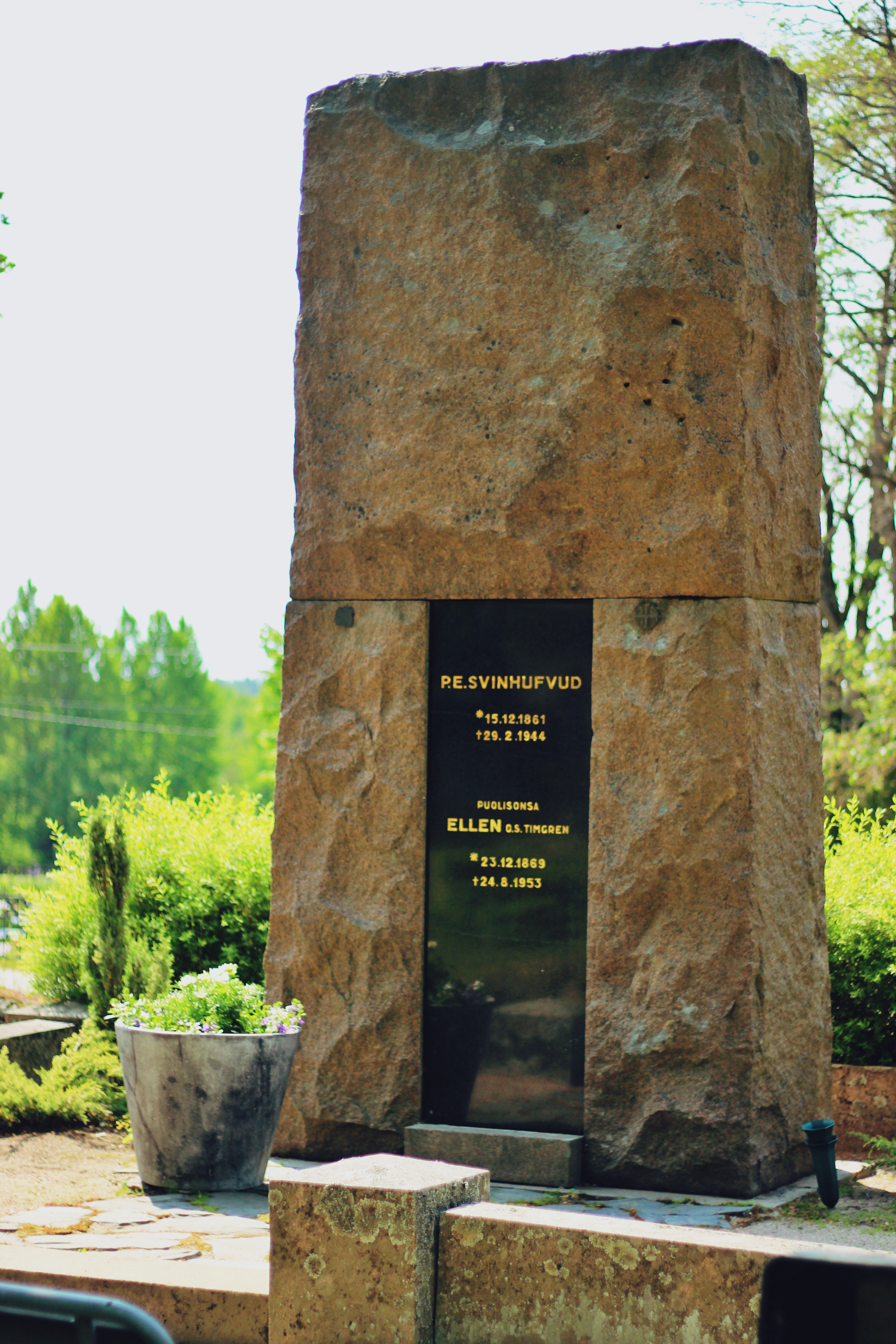
Kirkonmäen rakennuksiin kuuluvat kellotapuli vuodelta 1876 ja seurakuntatalo 1920-luvulta. Hautausmaan laidalla oleva paarihuone on tehty kirkon kattopaanuista. Lisäksi kirkonmäen kokonaisuuteen ovat kuuluneet aiemmin pappilat ja kaksi pitäjäntupaa. Kirkonmäellä on kaksi hautausmaata, Kirkon hautausmaa kirkkoa vastapäätä ja Saksalan hautausmaa tien toisella puolella. Saksalan hautausmaa otettiin uudelleen käyttöön 1920-luvulla. Kirkonmäellä sijaitsevat hautausmaat kävivät ajan myötä ahtaiksi ja jo vuonna 1890 valmistui Kankaan hautausmaa kuntaa halkovan päätien laitaan Salpausselän harjulle. Hautausmailla on useita muistomerkkejä. Merkittävimmät muistomerkit kirkonmäellä ovat sankarihautausmaa, P.E. Svinhufvudin hautamuistomerkki ja vapaussodan muistomerkki. Tänne on haudattu myös muita pitäjän merkkihenkilöitä.
Vähin erin kunnalliset toiminnot sijoittuvat Taavettiin 1900-luvun alussa ja seurakunta seurasi perässä. Taavetin hautausmaa ja kappeli vihittiin käyttöön 1950-luvulla, nykyinen seurakuntakeskus rakennettiin 1970-luvulla.
Tie Luumäen kirkonmäelle lähtee VT:6 liittymästä Rantsilanmäeltä etelään. Kirkonmäelle on matkaa noin 2,5 km. Kirkonmäellä on hyvä hetki huokaista hieman, istua hetkeksi ja päästää mielikuvitus valloilleen, mitä kaikkea tällä mäellä onkaan tapahtunut vuosisatojen aikana.
Luumäki church and church hill
The church hill dominates the surrounding field landscape. Approaching from the north on Highway 6, you will first notice the cemeteries on the hillside. At the intersection of the four roads is the parish house and on the slightly side bell tower and on the edge of a small square a wooden cruciform church. Both the Luumäki parish and the rural municipality of Luumäki were born in this place in 1642, when Luumäki resigned from the Lappee parish. The name Luumäki (direct translation: bone hill) refers to a pagan place of sacrifice. The stories tell that bear bones have been found on the present church hill and the place has been important to previous generations.
The first church was built during the chapel congregation as early as the middle of the 16th century. The next church, St. Mary's Church, was built across the road in 1731 and at the same time the cemetery was moved around it. The former cemetery was forgotten. The church and the belfry later built were destroyed in a fire in 1839. The present church, designed in the Empire style by C. L. Engel, was completed in 1845. The shape of the church is a cross with inclined inner corners and a large dome in the middle. There are about a thousand seats in the church. In 1913, the church was renovated according to the plans of architect Ilmari Launis. The current altarpiece “Jesus on the Cross” was painted by Martta Helminen in 1929. The former tin crucifix can be seen in the Fortress and Homeland Museum in Taavetti.
The buildings on the church hill also include a belfry built in 1876 and a parish hall built in the 1920s. The stretcher room on the edge of the cemetery is made of church shingles. The church hill has two cemeteries, the Church Cemetery opposite the church and the Saksala Cemetery across the road. The Saksala cemetery was reopened in the 1920s. The cemeteries on the church hill became cramped over time, and already in 1890 the Kangas cemetery was completed. There are several monuments in the cemeteries. The most significant monuments on the church hill are the Heroes' Cemetery, P.E. Svinhufvud’s cenotaph and War of Independence Memorial. Other prominent figures of the parish have also been buried there.
Gradually, municipal functions took place in Taavetti in the early 20th century, and the congregation followed. The cemetery of Taavetti and the chapel were consecrated in the 1950s, the current parish center was built in the 1970s.
The road to Luumäki church hill starts at the junction of Highway 6 south of Rantsilanmäki. The distance to the Luumäki church hill from there is about 2.5 km. The Luumäki church hill is an excellent place for enjoying the beautiful historical setting, and for enjoying the calm and restful atmosphere.
- Paikka maastokartalla/The place on a terrain map
- Google maps ajo-ohjeet/Google maps driving directions
In English below.
Suomen sisällissota eli vapaussota käytiin 27.1.–15.5.1918 heti Suomen itsenäistymisen jälkeen. Venäjällä tapahtuneet poliittiset muutokset, tsaarinvallan kaatuminen ja maailmansota mahdollistivat Suomen itsenäistymisen edellisen vuoden lopulla. Epävakaa tilanne aiheutti kuitenkin poliittisen ja sotilaallisen kriisin, joka johti sotaan tammikuussa 1918. Punaisten joukot hallitsivat Etelä-Suomea, valkoisten pohjoisempaa Suomea. Sodan ratkaisutaistelut käytiin maalis-huhtikuussa 1918. Tällöin valkoisten joukot valtasivat Etelä-Suomen isot kaupungit yhdessä saksalaisten kanssa. Sota vaati yli 37 000 ihmishenkeä, joista vain osa kuoli rintamalla, osa kuoli muissa väkivaltaisuuksissa ja osa vankileireillä.
Luumäellä kerrotaan käydyn vapaussodan ensimmäisiin ja viimeisiin kuuluneet taistelut. Ensimmäinen kahakka käytiin ennen sisällissodan varsinaista käynnistymistä jo tammikuun 21. päivänä. Luumäen valkoiset olivat muutamaa päivää aiemmin kaapanneet punaisten asekuljetuksen ja saaneet saaliiksi noin 70 kivääriä ja 10 000 patruuna. Lappeenrannasta lähti yli kahdensadan miehen punakaarti junalla Taavettiin hankkimaan aseita takaisin. Syntyneissä kahakoissa kuoli yksi henkilö molemmin puolin laukausten vaihdossa. Tilanne päättyi punaisten vetäytymiseen, kun huhu tuhansien valkoisten lähestymisestä kantautui punaisten korviin. Valkoisten kaatunut oli jääkäri Lauri Pelkonen ja hänelle on pystytetty muistomerkki Marttilantien varteen tapahtumapaikalle.
Helmikuun puoleen väliin mennessä oli koko pitäjä punaisten vallassa. Heidän päätehtävä oli junaradan liikenteen turvaaminen ja alue pysyi tärkeänä rintamantakaisena huoltoalueena. Satunnaisia kahakoita syntyi, kun rintamalle valkoisten puolelle menijät kulkivat Luumäen läpi tai rautatiekuljetuksia yritettiin sabotoida. Vasta huhtikuussa tilanne muuttui, kun valkoisten hyökkäys kohti Viipuria alkoi.
Vapaussodan viimeisiin kuulunut tai stelu käytiin valkoisten ja punaisten välillä Kiurulan kankaalla 1. toukokuuta 1918. Viipurin valtauksen alkaessa olivat punaisten rintamat jo osin hajallaan ja he lähtivät Etelä-Karjalan länsiosassa perääntymään kohti Kymenlaaksoa. Pulsan aseman menetys sai punaiset luopumaan Luumäen asemasta ja siirtymään länteen kirkon seutuville. Taistelut jäivät hetkeksi paikalleen. Valkoisten tykit ampuivat Kangasvarren nuoriseuran talolta ja punaiset kirkonmäen suunnalta kahden päivän ajan, kunnes punaisten tykkiasemien sijainti paljastui ja tilanne ratkesi punaisten peräytymiseen. Kahakointi jatkui vielä Taavetin suunnalle seuraavana päivänä.
Viimeisen taistelun paikalle pystytti Luumäen suojeluskunta muistomerkin 1930-luvulla. Muistomerkki on aivan Itsenäisyydentien varrella Kiurulan kankaalla. Vapaussodan valkoisten hautamuistomerkki sijaitsee Luumäen kirkonmäellä. Vakaumuksensa vuoksi kuolleiden punaisten hautamuistomerkki on Taavetin hautausmaalla.
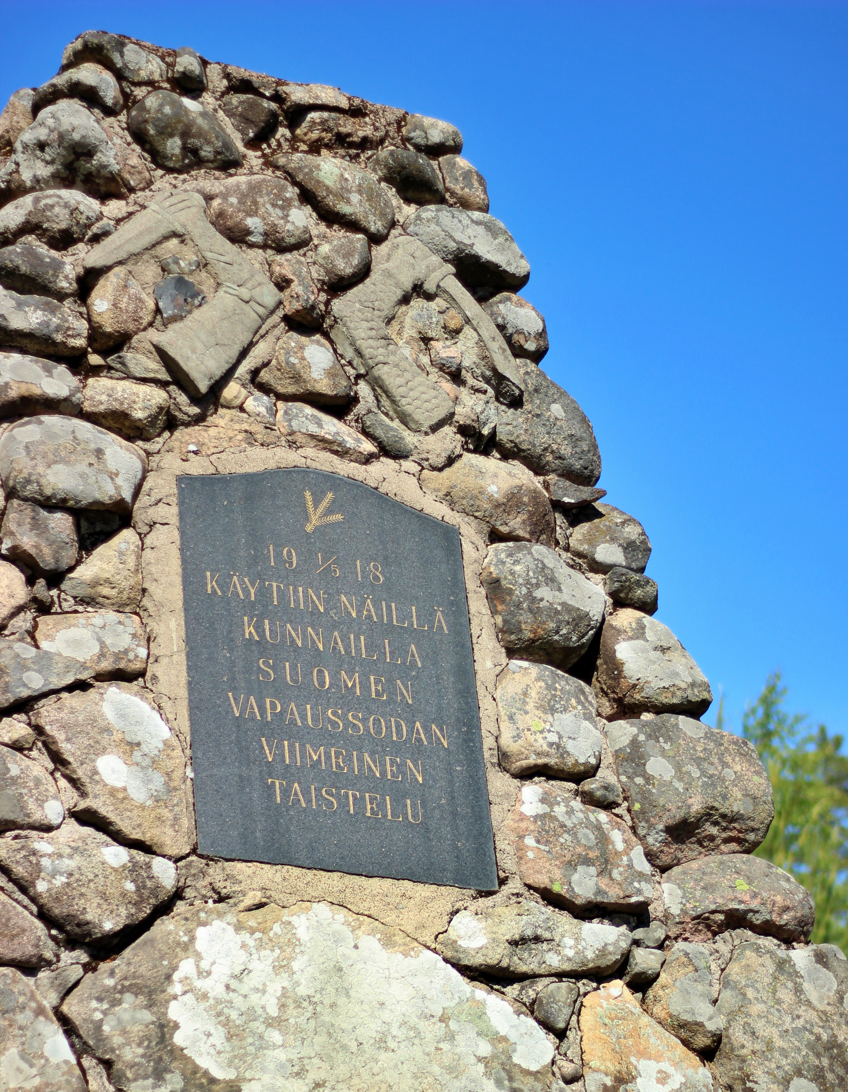
Monument to the last battle of the Finnish civil war
The Finnish civil war, or war of independence, was fought from January 27 to May 15, 1918, immediately after Finland's independence. The political changes that took place in Russia, the collapse of tsarist rule and World War I enabled Finland to become independent at the end of the previous year. However, the unstable situation caused a political and military crisis that led to the war in January 1918. The forces of the reds ruled southern Finland, the more northern Finland was ruled by the whites. The fighting that led to the settlement of the war was fought in March and April 1918. At that time, white troops occupied the big cities of southern Finland together with the Germans. More than 37,000 people died in the war, only some of them died on the front, some in other violence and some in prison camps.
It has been told that the first and last battles of the war took place in Luumäki. The first battle was fought before the actual start of the civil war on January 21st. A few days earlier, the white troops of Luumäki had hijacked the transport of the red troops and captured about 70 rifles and 10,000 rounds. The red guard of more than two hundred men left Lappeenranta by train to Taavetti to get those weapons back. One person died in the resulting battle. The situation ended with the retreat of the reds as rumors of thousands of the whites approaching the reds. Lauri Pelkonen, a Jaeger who fought in the whites, died in that battle, and a monument has been erected to him at the scene of his death.
By mid-February, the entire parish was in power with the reds. Their main task was to secure the traffic on the railway and the area remained an important behind-the-scenes maintenance area. Occasional riots arose when people going to the front of the whites passed through Luumäki or attempted to sabotage railway transports. It was not until April that the situation changed when the whites attack on Vyborg began.
One of the last battles of the War of Independence was fought between whites and reds in Kiurula on May 1, 1918. At the beginning of the occupation of Vyborg, the fronts of the reds were already partly scattered, and they retreated towards the Kymenlaakso in the western part of South Karelia. The loss of Pulsa's station caused the reds to relinquish their position in Luumäki and move west to the church areas. Whites’ cannons fired from the house of the Kangasvarsi youth club and red ones from the direction of the church hill for two days until the location of the red artillery stations was revealed and the situation was resolved for the red to retreat. The fighting continued in the Taavetti area the next day.
The Luumäki conservatory erected a monument on the site of the last battle in the 1930s. The monument is right along the Itsenäisyydentie road in Kiurula. The whites’ tomb of the civil war is located on Luumäki church hill. The tomb of the reds who died because of their beliefs is in Taavetti’s cemetery.
- Paikka maastokartalla/The place on a terrain map
- Google maps ajo-ohjeet/Google maps driving directions
In English below.
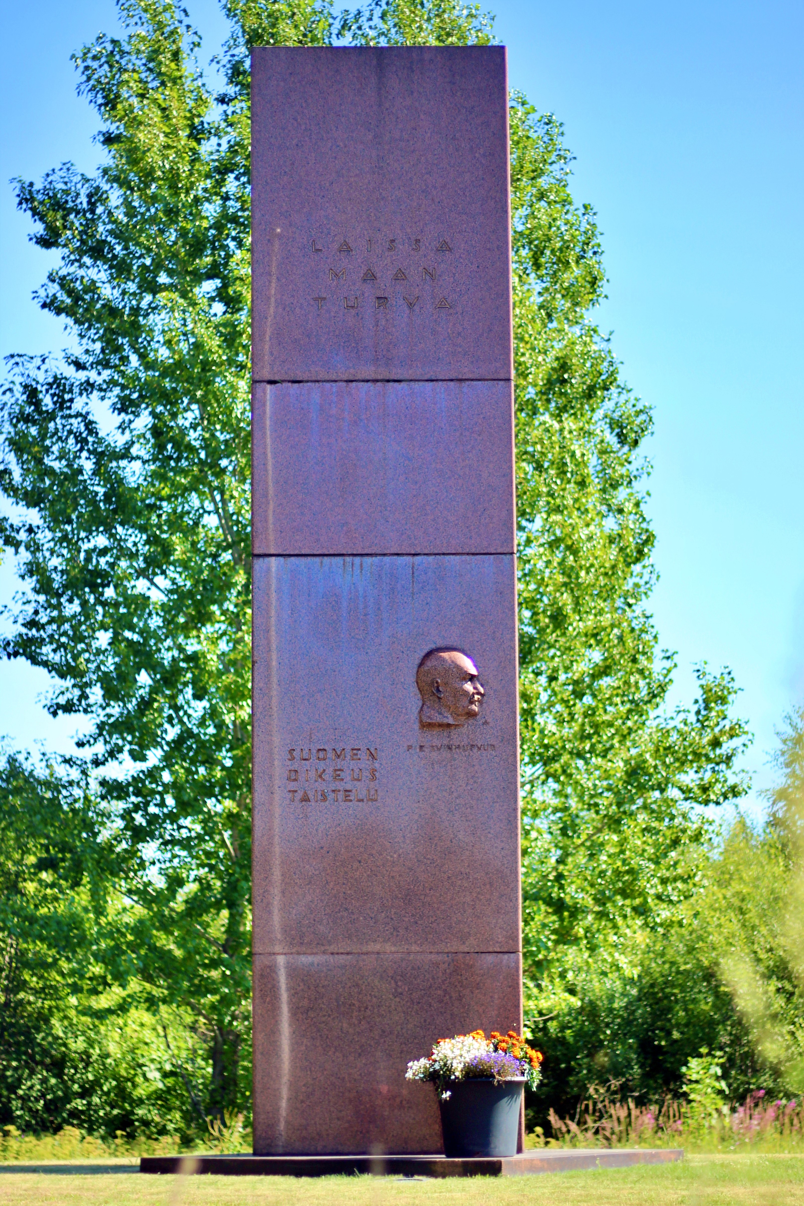
Graniittinen patsas on pystytetty Venäjän vallan ajan loppupuolella esiintynyttä sortoa vastaan käydyn oikeustaistelun merkiksi. Se ei ole tehty vain presidentti P.E. Svinhufvudin kokemien tapahtumien muistoksi vaan muistoksi koko Suomen kansan taistelulle oikeuden puolesta. Taistelu päättyi Suomen itsenäistymiseen 1917.
Aloite muistomerkin perustamisesta syntyi Luumäen Kotiseutu- ja Museoyhdistyksessä 1930-luvun puolivälissä. Alkuperäisenä ajatuksena oli kunnostaa Luumäen vanha käräjätalo, josta silloinen kihlakunnan tuomari P.E. Svinhufvud haettiin vallanpitäjän laittomiksi katsomilta käräjiltä. Hänet vangittiin ja vietiin karkotukseen pariksi vuodeksi Siperiaan marraskuussa 1914. Rakennuksen kunnostaminen ei kuitenkaan toteutunut, vaan päädyttiin patsaan hankintaan Luumäen asemalle.
Muistomerkin suunnittelusta järjestettiin suljettu kutsukilpailu kesällä 1937, jonka kuvanveistäjä Wäinö Aaltonen voitti kolmikulmaisen patsaan luonnoksella. Patsaan tekemiselle tuli kiire, sillä sen paljastustilaisuus oli tarkoitus olla itsenäisyyden 20. päivän aattona. Patsaan toteutti Kiviveistämö Oy Forsman Helsingistä yhdessä Wäinö Aaltosen kanssa. Toimitukseen sisältyi muistomerkin valmistus, perustukset ja pystytys. Patsas ehdittiin saada paikalleen juuri ennen juhlallisuuksia 30.11. Muistomerkki on 7 metriä korkea ja sen sivut ovat 1,5 metriä leveitä ja se on tehty Vehmaan punertavasta graniitista.
Muistomerkki paljastettiin juhlallisesti 5.12. Paikalle oli saapunut arvokas kutsuvieraiden joukko P.E. Svinhufvudin johdolla sekä pari tuhatta katsojaa. Paljastuksen jälkeen järjestettiin läheisellä Kangasvarren koululla juhlapäivälliset sekä iltajuhla nuorisoseurantalolla.
Muistomerkki ei ole alkuperäisellä paikallaan, vaan sitä siirrettiin vuonna 2009 neljätoista metriä ratapihan laajentumisen ja lisäraiteen rakentamisen takia. Vuonna 2017 valmistui uusi VT6:n linjaus ja muistomerkki on jäänyt rautatien ja valtatien väliin kapealle kaistaleelle asemarakennuksen itäpuolelle. Se näkyy vilaukselta tiellä liikkujille. Muistomerkille on kulku Itsenäisyydentien kautta. Jurvalan Salen kohdalta käännytään etelään Suoanttilan tielle ja ennen rautatietä on opasteet.
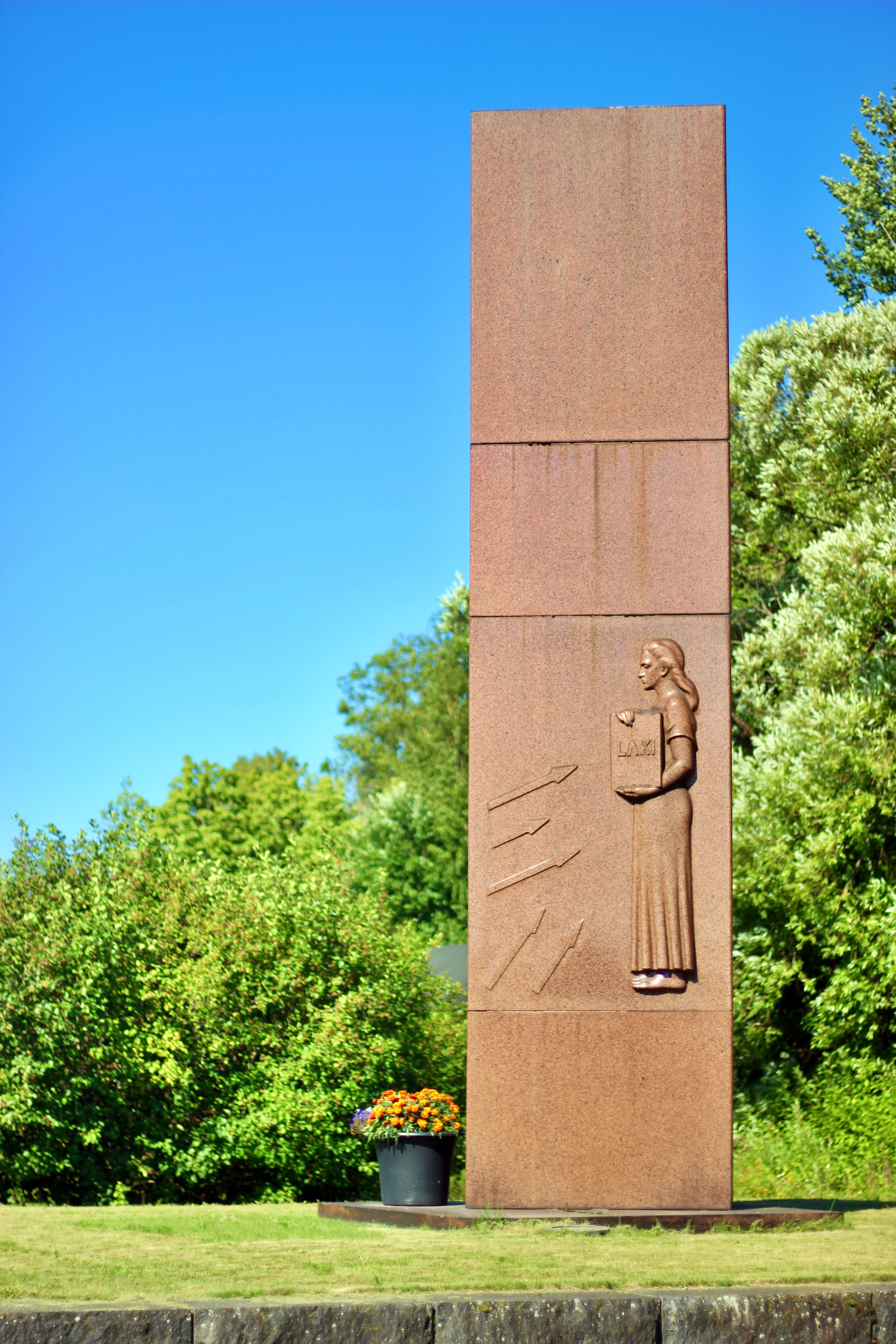
Monument to the legal battle
A granite statue has been erected as a sign of the legal battle against the repression that took place during the end of Russian rule. It is made not only to commemorate the events experienced by President P.E. Svinhufvud, but to commemorate the struggle for justice of the whole nation of Finland. The battle ended with Finland 's independence in 1917.
The initiative to establish the monument was born in the Luumäki Homeland and Museum Association in the mid-1930s. The original idea was to renovate Luumäki's old town hall, from which the then district judge P.E. Svinhufvud was sought from the councils deemed illegal by the ruler. He was imprisoned and deported to Siberia for a couple of years in November 1914. However, the renovation of the building did not take place, and a statue was purchased for Luumäki station.
A closed invitation competition was held for the design of the monument in the summer of 1937, which was won by sculptor Wäinö Aaltonen with a sketch of a triangular statue. There was a rush to make the statue, as it was supposed to be unveiled on the eve of the twentieth Independence Day. The statue was designed by Kiviveistämö Oy Forsman from Helsinki together with Wäinö Aaltonen. The delivery included the manufacture, foundations and erection of the monument. The statue was put in place just before the festivities on 30th of November. The monument is 7 meters high, and its sides are 1.5 meters wide, and it is made of reddish granite from Vehmaa.
The monument was solemnly unveiled on 5th of December. A valuable group of invited guests led by P.E. Svinhufvud and a couple of thousand spectators had arrived. After the unveiling, a festive dinner was held at the nearby Kangasvarsi school, as well as an evening party at the youth observatory.
The monument is not in its original location as it was moved in 2009 14 meters due to the expansion of the yard and the construction of an additional track. In 2017, a new alignment of Highway 6 was completed, and the monument is left on a narrow swathe east of the station building between the railway and the highway. It can be seen at a glance as you drive down the road. There is a passage to the monument through the Itsenäisyydentie road. At Jurvala Sale, turn south onto Suoanttila road and there are signs before the railway.
In English below.
Kivijärven pato on osa viime sotien aikana rakennettua puolustuslinjaa eli Salpalinjaa. Vaikka puolustuslinjan rakentamisessa hyödynnettiin hyvin vesistöjä esteinä, varsinaiset patoamiset ja tulvitusalueet olivat harvinaisia. Niiden tarkoituksena oli parantaa vesistön estearvoa ja laajentaa panssareille sopimattomia kulkuväyliä. Talvella virtaamien ylläpito vesistöissä olisi heikent änyt jään kantavuutta.
Salpalinjalle tulvitusalueita rakennettiin kolme, joista Luumäellä oleva on laajin. Se käsittää alueen Kivijärvestä -Suur-Urpalanjärven eteläpuolelle. Suunnitelma perustui järvien 15 metrin korkeuseroon, Salpausselän harjun läpi rakennettavaan viemäriin sekä viiteen alapuoliseen säännöstelypatoon. Koska Suur-Urpalanjärvellä on kaksi laskuojaa ja yksi tulo-oja, pystyttiin tulvitusalueita rakentamaan padotuksilla kolmeen eri suuntaan järvestä. Vesiesteiden kokonaispituus olisi ollut enimmillään noin 8 km ja se olisi muodostanut huomattavan vesiesteen.
Kivijärven pato on tulvitusjärjestelmän ylin osa, jossa kolmella settipadolla voitiin säädellä alapuoliselle alueelle laskettavan veden pinnan määrää. Käytettävien settien eli betonipalkkien määrää säätämällä voitiin lisätä tai vähentää veden juoksutusta padossa. Harjun läpi ja tien alitse rakennettiin viemäri, joka koostui suunnitelmien mukaan kolmesta halkaisijaltaan noin metrisestä betoniputkesta. Laaja tulvitusalue olisi saavuttu laskemalla vettä seitsemän vuorokauden ajan. Tällöin Suur-Urpalanjärven pinta olisi noussut noin puoli metriä. Kivijärven pinta olisi laskenut vastaavasti muutamia kymmeniä senttejä.
Ensimmäistä kertaa Kivijärven veden käyttämistä eteläpuolisen alueen tulvituksessa ehdotettiin käytettäväksi jo ylimääräisten harjoitusten aikana. Varsinaisen tulvitusjärjestelmän rakentaminen tapahtui väirauhan aikana ja patoa käytettiin kesällä 1944.
Kivijärven pintaa laskettiin 1960-luvulla ja pato on nykyään kuivalla maalla järven ja tien välisellä alueella.
Kivijärven pato sijaitsee Itsenäisyydentien ja Kivijärven välisessä alueella kapealla maa-alueella. Padon kohdalla ei ole pysäköintiä vaan sinne pääsee helpoiten kävellen joko Kahvi-Pakarin tai Hotelli Salpan suunnalta.
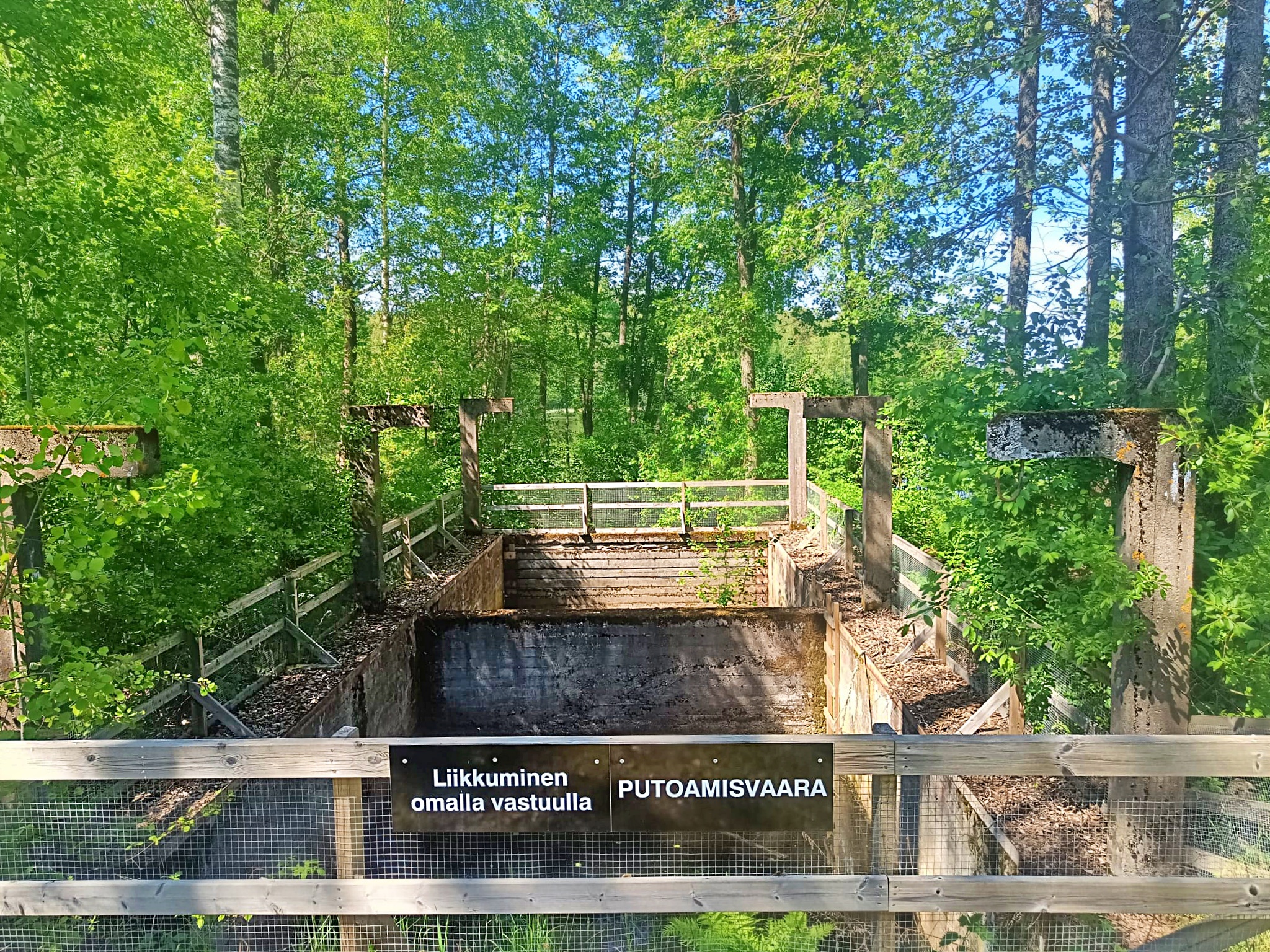
Kivijärvi dam
Kivijärvi dam is part of Salpa line. Although waters were well utilized as barriers in the construction of the line of defense, actual dams and floodplains were rare. They were intended to improve the barrier value of the body of water and to widen access routes unsuitable for armor. In winter, maintaining flows in water bodies would have reduced ice bearing capacity.
Three floodplains were built on the Salpa line, the largest of which is in Luumäki. It covers the area from Lake Kivijärvi to the south of Lake Suur-Urpalanjärvi. The plan was based on a 15-meter elevation difference of the lakes, a sewer to be built through the Salpausselkä ridge, and five regulatory dams below. As Lake Suur-Urpalanjärvi has two gutters and one inlet ditch, it was possible to build floodplains with dams in three different directions from the lake. The total length of the water barriers would have been a maximum of about 8 kilometers and would have formed a significant water barrier.
The Kivijärvi dam is the upper part of the flooding system, where the amount of water level discharged into the area below could be regulated by three set dams. By regulating the number of sets used, ie concrete beams, it was possible to increase or decrease the flow of water in the dam.
A sewer was built through the ridge and under the road, which was planned to consist of three concrete pipes about a meter in diameter. A large flooding area would have been achieved by lowering the water for seven days. In that case, the surface of Lake Suur-Urpalanjärvi would have risen by about half a meter. The surface of Lake Kivijärvi would have decreased by a few tens of cents.
For the first time, the use of Kivijärvi water in the flooding of the southern area was proposed to be used already during the extraordinary exercises. The construction of the actual flooding system took place during the peace period and the dam was used in the summer of 1944.
The surface of Lake Kivijärvi was lowered in the 1960s and the dam is now on dry land in the area between the lake and the road.
The Kivijärvi dam is located in a narrow area between Itsenäisyydentie road and Lake Kivijärvi. There is no parking at the dam, it is easiest to get there on foot from either Kahvi-Pakari or Hotelli Salpa.
In English below.
Suomen itärajaa myötäilee linnoiteketju Salpalinja, joka rakennettiin vuosien 1940–41 ja -44 aikana. Puolustuslinjan tarkoituksena oli suojella Suomea vihollisen, silloisen Neuvostoliiton, hyökkäystä vastaan. Salpalinjan rakenteita on Suomenlahdelta Lappiin asti. Vahvimmin linnoitettiin Suomenlahden ja Luumäen Kivijärven välinen osuus, siitä ylöspäin linnoitettiin vesistöjen kannakset ja tärkeimmät tieyhteydet. Rauha solmittiin ennen kuin taistelut ehtivät Salpalinjalle asti ja siksi linnoitteet ovat säilyneet tähän päivään asti. Nyt Salpalinja on meille muistomerkki viime sodista ja se on verrattavissa muihin eurooppalaisiin II maailman sodan linnoitteisiin. Luumäki on yksi vahvimmin linnoitettuja paikkakuntia.
Erityisen vahvasti linnoitettiin Kivijärven eteläpuolista aluetta, jonka kautta kulkevat maantie ja rautatie lännestä itään. Salpa-aseman kohdalla kulkevan pääaseman lisäksi on Toikkalan etuasema sekä takana ns. Askolan asema. Kaikkiaan pääaseman tuntumassa linnoitteita on noin kolmen kilometrin matkalla. Kauempana lännessä ovat tukena vielä Pappilan linja ja Hamina-Taavetti-linja.
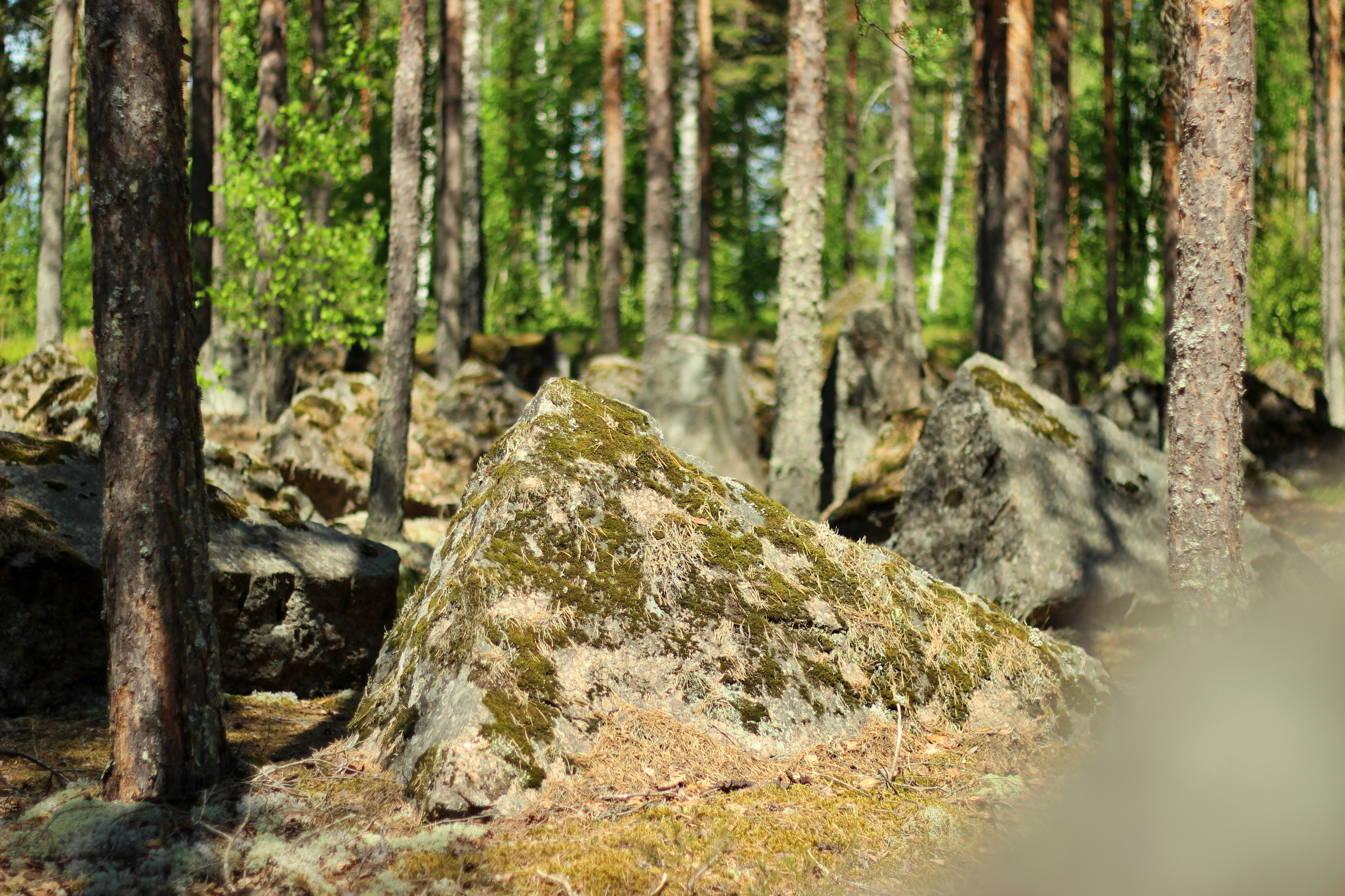
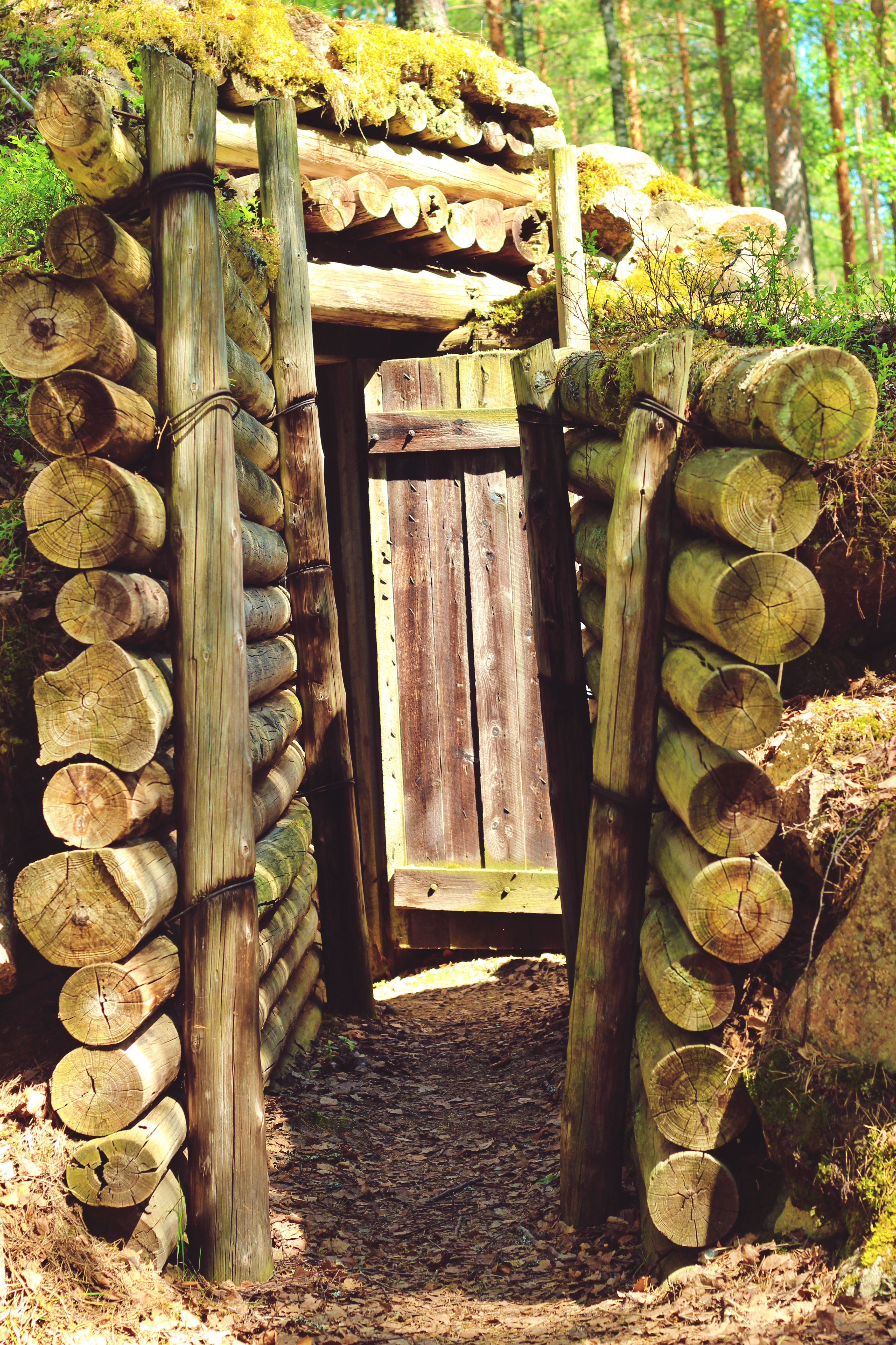
Salpa-aseman korsut sijaitsevat hiekkapohjaisessa kangasmaastossa Salpausselän harjulla aivan Itsenäisyydentien varrella. Kivijärven ja Suur-Urpalanjärven välisellä alueella on kaikkiaan 33 linnoituslaitetta, joista Salpa-aseman esittelykohteessa on useampaa eri tyyppiä. Alueella sijaitsevat panssaritorjuntatykin ja konekiväärin yhdistelmäkorsu, konekiväärikorsu, konekiväärikupupesäke sekä majoituskorsu. Konekiväärikorsun edessä on lisäksi panssarivaunun tornista tehty teräspesäke. Alueella on lisäksi panssariestekiviä sekä kaivantoesteitä. Puolustuslinjan torjuntasuunta on itään Lappeenrannan ja Kouvolan välisen maantien suuntaan.
Salpa-asemaan on helppo tutustua. Siellä löytyvät polut, opasteet ja opastustaulut. Pysäköinti onnistuu läheisellä levähdysalueella. Korsut ovat avoinna kesäisin ja tilauksesta. Alueeseen voi tutustua omatoimisesti tai opastetusti.
Salpa-asema on maanomistajan ylläpitämä kohde. Alueen korsujen avoinnaolosta ja opastuksista voi tiedustella joko Heli (puh. 0400 752 807) tai Kari (040 824 0335) Huotarilta tai sähköpostilla huotari.kari-heli(at)pp.inet.fi.
Opastuksista voi kysyä lisätietoa myös Salpalinjan Oppaat ry:ltä, tiedustelut salpalinjan.oppaat(at)gmail.com.
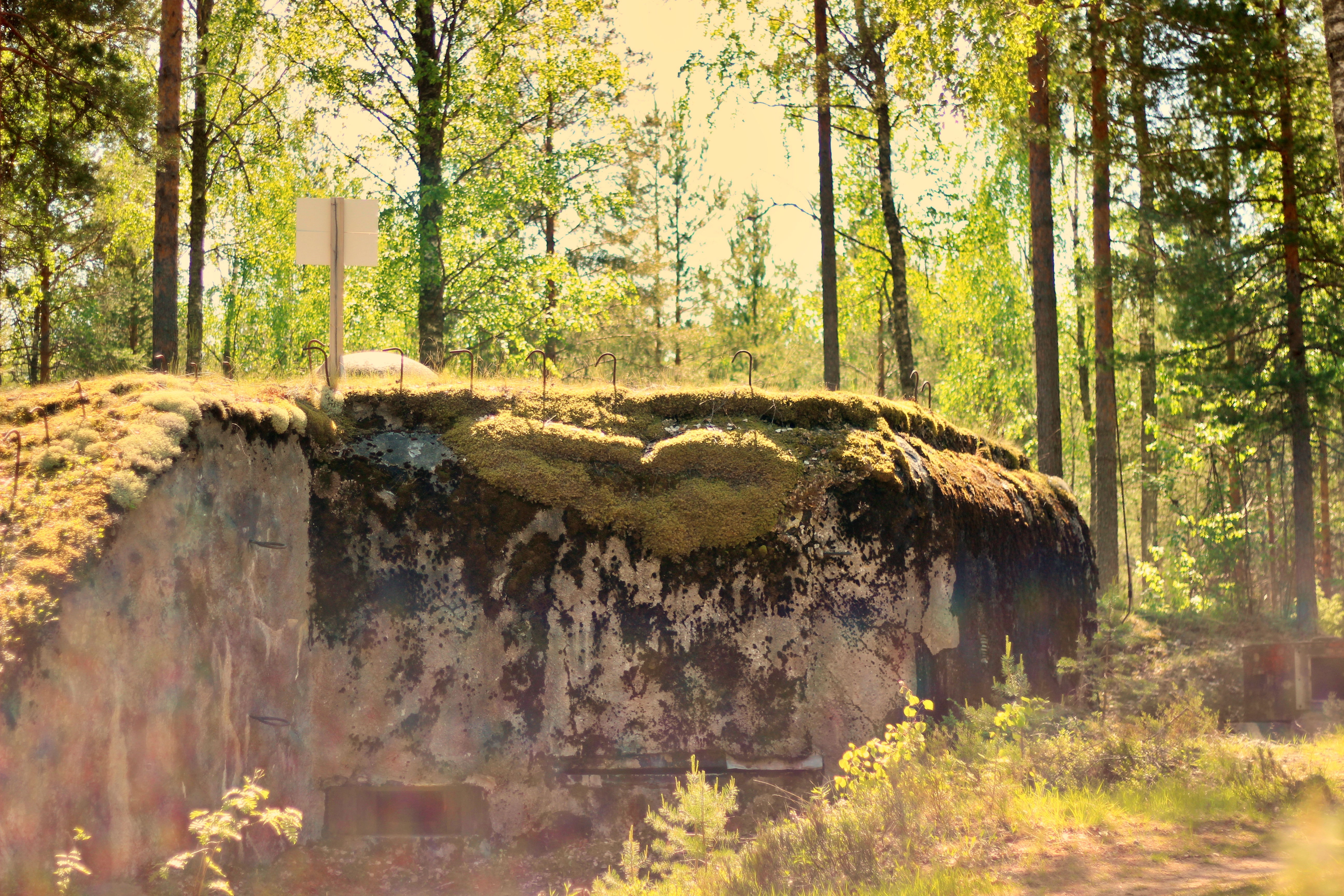
Salpa-asema
Salpa Line is a defence line built between 1940 and 1944 on the eastern border of Finland. The purpose of the line of defense was to protect Finland against the attack of the enemy, which was the Soviet Union at the time. The structures of the Salpa Line extend from the Gulf of Finland to Lapland. The fortification was the strongest between the Gulf of Finland and Lake Kivijärvi. North of Lake Kivijärvi, only isthmuses and main roads were fortified. However, peace was made before the armies reached the Salpa Line, leaving the fortifications intact. Nowadays the Salpa Line is a monument to the most recent wars and is comparable to other European fortifications built during the Second World War. Luumäki is one of the strongest fortified places.
The area south of Lake Kivijärvi, through which roads and railways run from west to east, was fortified particularly strongly. In addition to the main position at Salpa-asema, there is Toikkala's front position and the so-called Askola's position. In total, there are fortifications within a radius of about three kilometers near the main position. Further west, the Pappila line and the Hamina-Taavetti line also support it.
The dugouts of the Salpa asema are located on a sand-based terrain on the ridge of Salpausselkä, right along Itsenäisyydentie road. There are a total of 33 fortification devices in the area between Kivijärvi and Suur-Urpalanjärvi, of which there are several different types at the Salpa-asema demonstration site. In the area there is a combined dugout of an anti-tank cannon and a machine gun, a machine gun dugout, a machine gun nest and an accommodation dugout. In addition, there is a steel nest made from the armored car tower in front of the machine gun dugout. There are also armored barriers and excavation barriers in the area. The direction of the defense line is to the east in the direction of the road between Lappeenranta and Kouvola.
The Salpa Line is easy to explore. There are paths, signposts and information boards to help you explore the area. Parking is possible at a nearby rest stop. The dugouts are open during the summer and by appointment. You can explore the area on your own or with a guide.
Salpa-asema is maintained by the landowner. You can inquire about the opening and guidance of the dugouts in the area from either Heli (tel. 0400 752 807) or Kari (tel. 040 824 0335) Huotari or by e-mail huotari.kari-heli(at)pp.inet.fi.
You can also ask for more information about the guides from Salpalinjan Oppaat ry, inquiries at salpalinjan.oppaat(at)gmail.com.
- Paikka maastokartalla/The place on a terrain map
- Google maps ajo-ohjeet/Google maps driving directions
In English below.
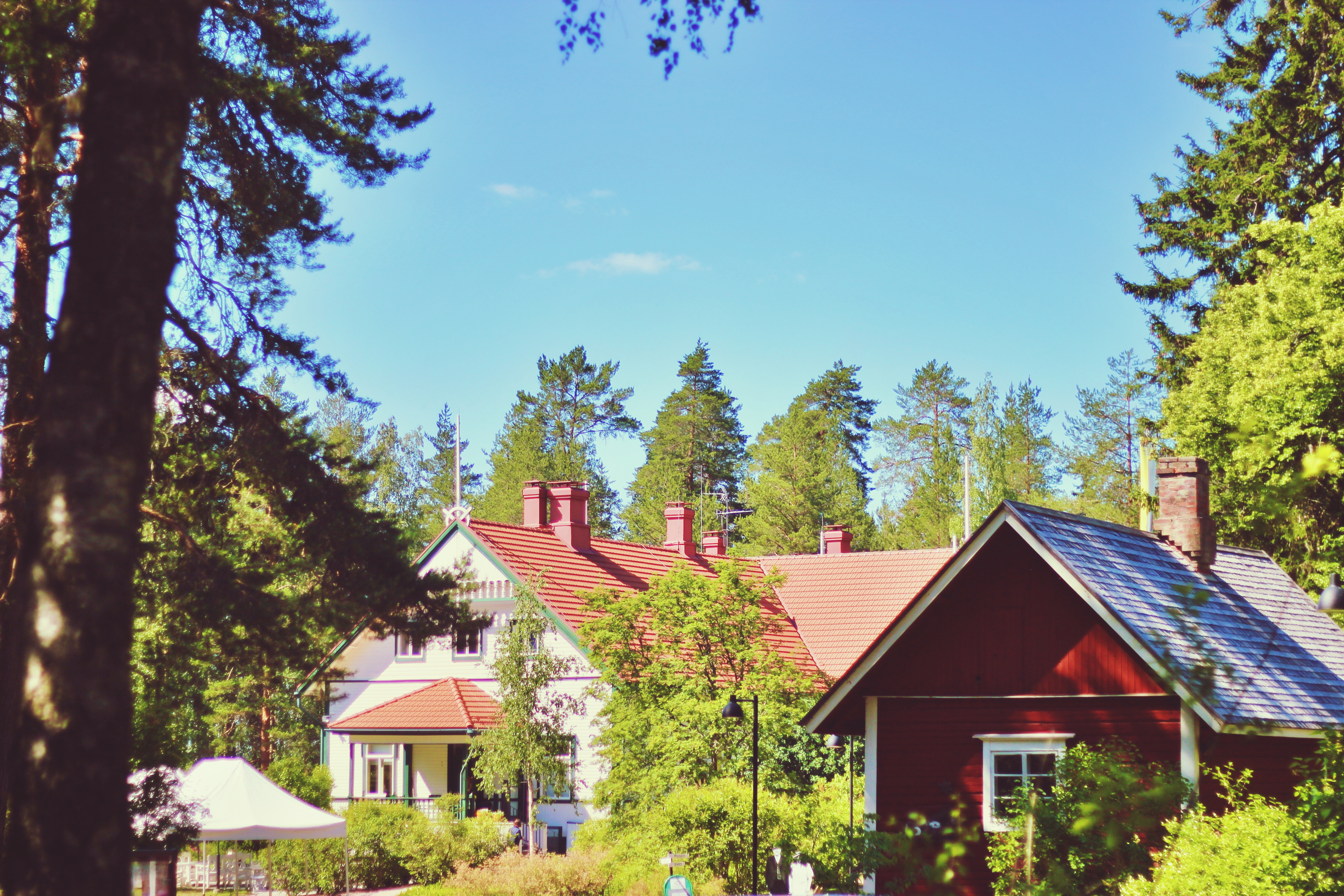
Luumäen ja Itsenäisyydentien eräs merkittävimmistä kohteista on Kotkaniemi, presidentti P.E. ja rouva Ellen Svinhufvudin koti. 1800-luvun lopulla rakennettu jugend-vaikutteinen huvila on nykyään kunnostettu käyntikohde, joka esittelee sekä Svinhufvudien elämää että Suomen itsenäistymisvaiheen historiaa. Svinhufvudilla oli merkittävä rooli Suomen itsenäistymisen eri vaiheissa sekä presidenttinä vuosina 1931–1937.
P.E. Svinhufvud tai tuttavallisemmin Ukko-Pekka osti tämän paikan saadessaan nimityksen Lappeen kihlakunnan tuomariksi vuonna 1908. Kotkaniemi oli perheelle rakas koti puutarhoineen ja tiluksineen. Sinne palattiin aina mieluusti virkavelvollisuuksien salliessa. Kotkaniemestä alkoi myös Ukko-Pekan viimeinen matka kohti Luumäen kirkonmäkeä vuonna 1944 jatkosodan vielä jatkuessa.
Kotkaniemen päärakennus sijaitsee mäntyjä kasvavalla niemellä kirkkaan Kivijärven äärellä. Se on kunnostettu 1930-luvun henkeen ja vierailu siellä on kuin visiitti entisajan maalaisvirkamiehen kotiin. Pihapiirissä riittää katseltavaa Ellenin aikaisessa puutarhassa, niemen kärjessä on Ukko-Pekan oma ampumarata ja vanhat Luumäen linnoitushistoriaan liittyvät tuliasemat. Kävelyretki Koppolniemen kärkeen nauttimaan Kivijärven kauniista maisemasta irrottaa hetkeksi arjesta.
Kotkaniemeä ja sen ympäristöä kehitetään Kotkaniemi-säätiön toimesta vaiheittain monipuoliseksi tapahtumapaikaksi, jossa jossa voi joko osallistua itse aktiivisesti toimintaan tai vain nauttia paikan ilmapiiristä.
Kotkaniemi sijaitsee Itsenäisyydentien varrella Jurvalan taajaman itäpuolella. Kotkaniemi avautui yleisölle 19.5.2018.
Tarkista avoinnaoloajat ja tiedot tapahtumista www.kotkaniemi.fi -sivuilta. Kahvila Ellen museorakennuksen toisessa päässä tarjoilee herkkuja Ellen Svinhufvudin reseptien pohjalta.
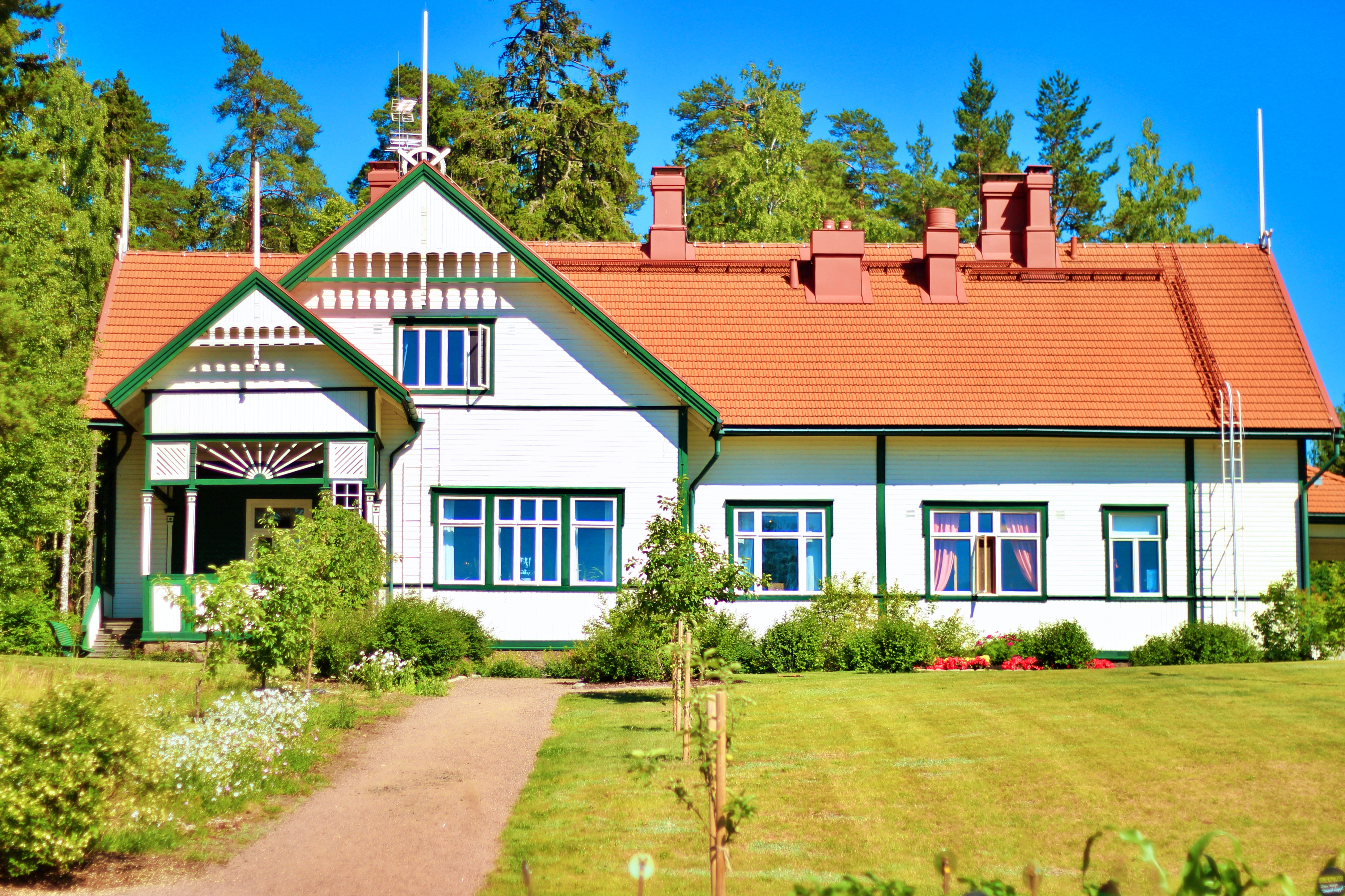
Kotkaniemi
One of the most significant attractions of Luumäki and Itsenäisyydentie road is Kotkaniemi, the home of President P.E. Svinhufvud and his wife, Ellen Svinhufvud. Built in the late 1800s, the Art Nouveau -style mansion has been renovated and is open to visitors. The mansion introduces the life of Mr. and Mrs. Svinhufvud and the history of Finnish independence. Svinhufvud played a significant role in the various stages of Finland's independence and as president in 1931–1937.
P.E. Svinhufvud or more familiarly Ukko-Pekka bought this place when he was appointed judge of the parish of Lappee in 1908. Kotkaniemi was a dear home for the family with its gardens and facilities. It was always a pleasure to return there when official duties allowed. Ukko-Pekka's last journey towards Luumäki church hill also began in Kotkaniemi in 1944, while the Continuation War was still going on.
The main building in Kotkaniemi is located on a pine-growing peninsula by the clear Lake Kivijärvi. It has been restored to the spirit of the 1930s and a visit there is like a visit to the home of a rustic official. In the courtyard, there is plenty to see in Ellen's garden, at the head of the headland are Ukko-Pekka's own shooting range and old positions related to the history of Luumäki fortress. A walk to the top of Koppolniemi to enjoy the beautiful scenery of Lake Kivijärvi helps you to take a break from everyday life.
Kotkaniemi and its surroundings are being developed step by step by the Kotkaniemi Foundation into a versatile venue where you can either participate in the activities or just enjoy the atmosphere of the venue.
Kotkaniemi is located along Itsenäisyydentie road, east of the Jurvala built-up area. Kotkaniemi opened to the public on May 19, 2018.
Check the opening hours and information about the events at www.kotkaniemi.fi. The café Ellen at the other end of the museum building serves delicacies based on recipes from Ellen Svinhufvud.
- Paikka maastokartalla/The place on a terrain map
- Google maps ajo-ohjeet/Google maps driving directions
In English below.
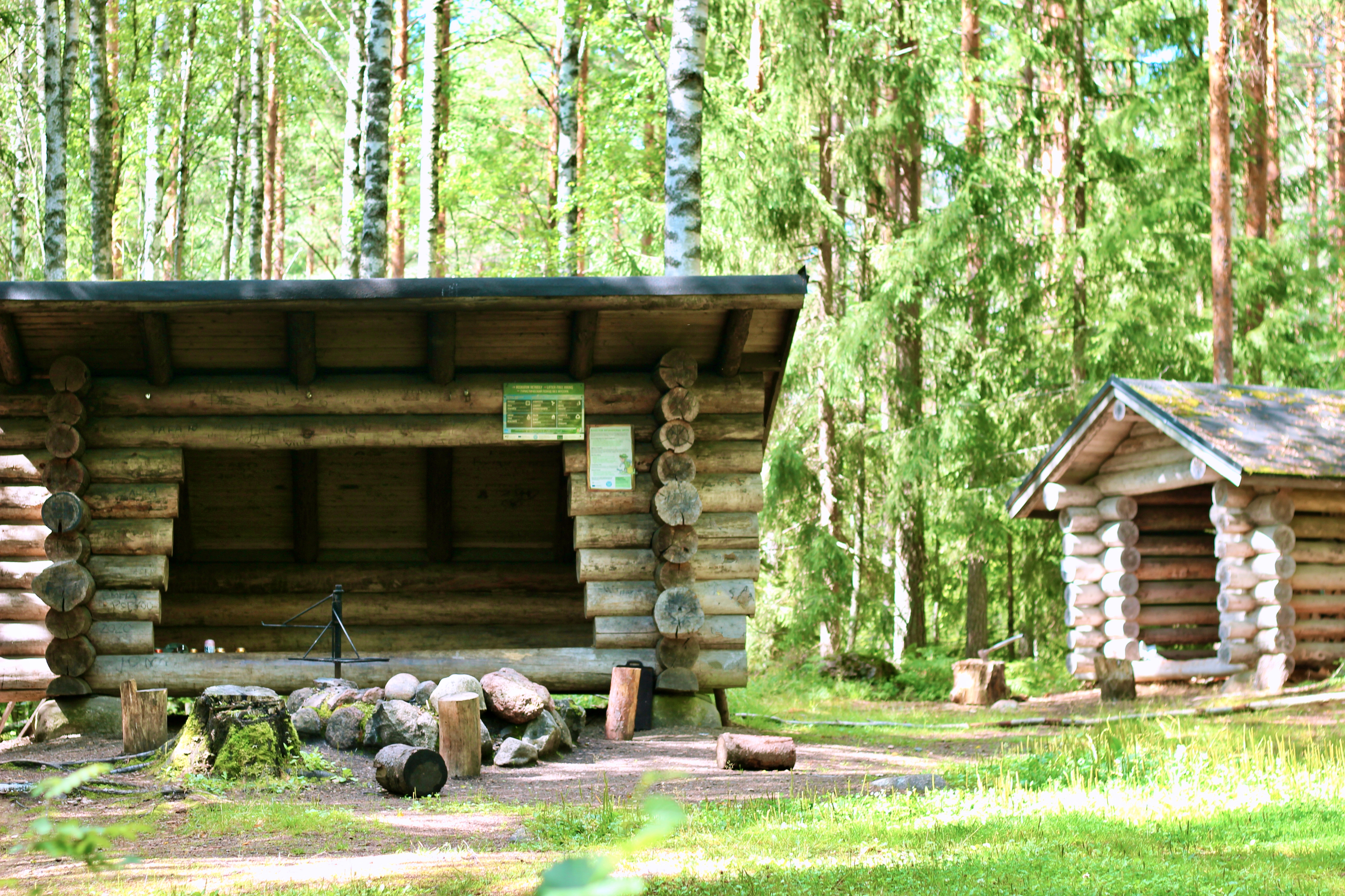
Huopaisenvirran vaellusreitin suosituimpana kohteena on Huopaisenvirran laavu, sille voi saapua kävellen joko etelästä Taavetin suunnasta tai pohjoisen kautta Virtalantien suunnasta, tien kääntyessä länteen jatka matkaa etelään laavullu. Laavulla voi levähtää ja tutustua myös paikan historiaan.
Väliväylän uitto
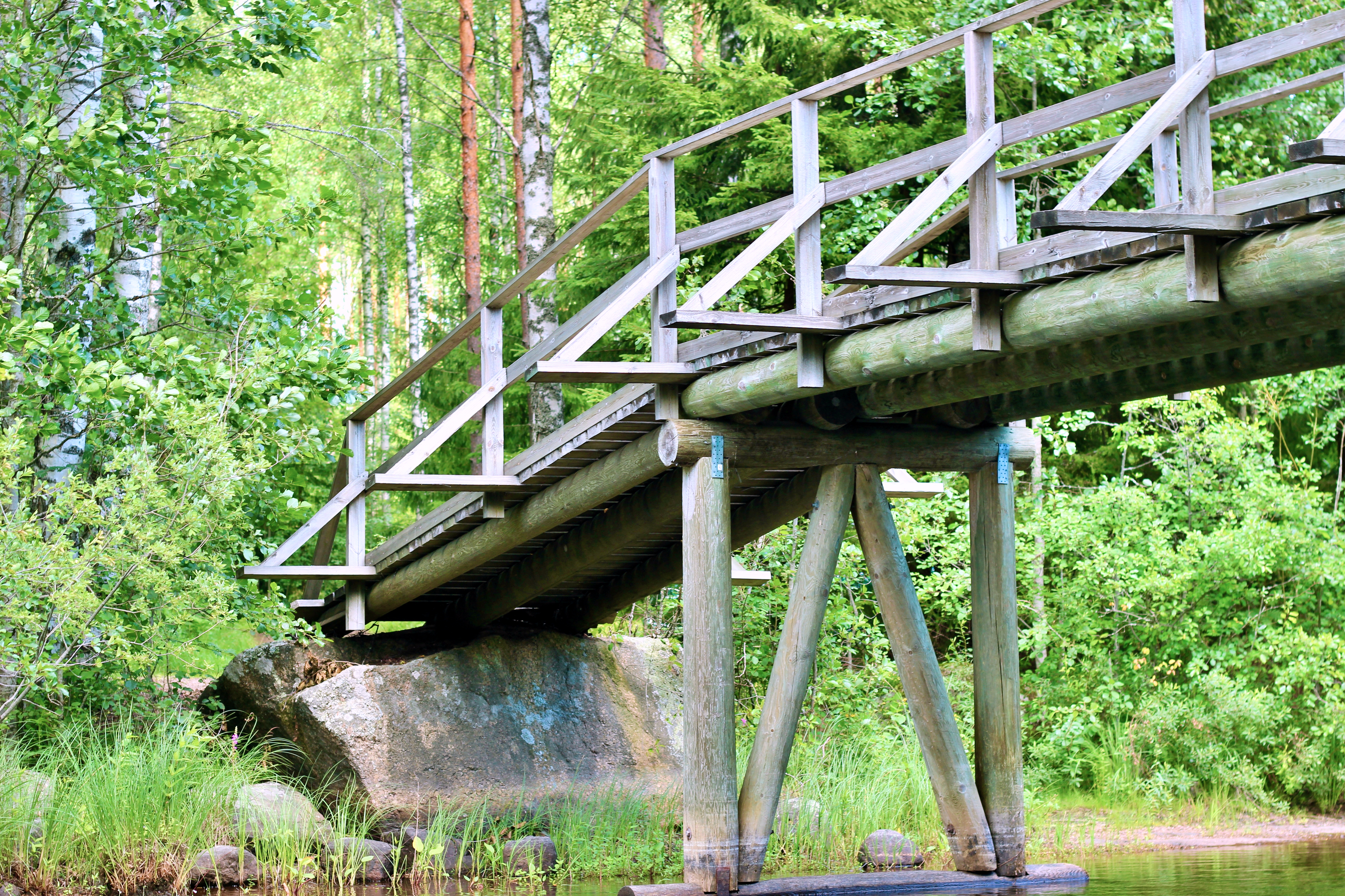
Kivijärven kautta kulkenut Väliväylän uittoreitti on osa Suomen metsäteollisuuden historiaa, se kulki mutkitellen Lappeen Rutolasta Luumäen ja Valkealan kautta Kymijokeen. Väylä oli käytössä noin 70 vuoden ajana 1960-luvun alkuun asti.
Kaksi kilometriä pitkä Huopaisenvirta oli yksi Väliväylän ongelmapaikkoja. Virta oli niin kapea, ettei siinä voinut kuljettaa lauttoja, mutta toisaalta liian leveä, ettei virta kunnolla kuljettanut puita. Korkeuseroa Huopaisenvirralla oli ennen Kivijärven veden pinnan laskua reilut 40 cm ja Huopaisenvirran alasuussa kapeikossa virta oli riittävä riittävä tukkien kuljettamiseksi. Viimeisten vuosikymmenien aikana puuta kulki virran läpi 27 000 tukkia vuorokaudessa. Välillä puuta tuli niin paljon, etteivät alukset ehtineet kuljettaa niitä pois ja syntyi ruuhkaa. Puut koottiin uudelleen lauttoihin Ala-Kivijärven puolella. Mielikuvitusta joutuu käyttämään, kun kuvitelee jatkuvan tukkien virran ja työn touhun nyt niin rauhalliseen paikkaan.
Linnoitustyöt
Viime sotien aikaiset linnoitustyöt uloittuvat myös Väliväylälle ja Huopaistenvirralle. Linnoitustöitä aloiteiltiin täällä jo vuoden 1939 aikana ja niitä jatkettiin talvisodan jälkeen. Uittoreittiä hyödynnettiin vesiesteenä. Pohjoisesta laavulle tultaessa kulkee mäen rinteessä jo osittain maatunut taisteluhauta asepesäkkeineen, joka kattaa Huopaisenvirran pohjoispuolen. Samaan aikaan kaivantoja on tehty myös muualla Väliväylän tuntumaan sekä Kivijärven saariin väylän pohjoispuolelle. Etelämpänä Huopaisenvirran reitin varrella Kukaslammen läheisyydessä on vuonna 1939 tehtyjä linnoitteita, taisteluhautaa ja suokaivantoa, jonka tunnistaa sik-sak-muotoisesta syvästä ojasta.
Huopaisenvirta lean-to
The most popular destination on the Huopaisenvirta hiking trail is the Huopaisenvirta lean-to. You can get there by walking either from the south in the direction of Taavetti or through the north from the direction of Virtalantie, as the road turns west, continue your journey south to the lean-to. At the lean-to you can relax and also learn about the history of the place.
Väliväylä log floating route
The Väliväylä log floating route that passed through Lake Kivijärvi is part of the history of the Finnish forest industry. The route meandered from Rutola in Lappee via Luumäki and Valkeala to Kymijoki. The route was in use for about 70 years until the early 1960s.
The two-kilometers long River Huopaisenvirta was one of the most problematic sections of the route. The river was so narrow that it could not carry ferries, but on the other hand it was too wide for the river to carry trees properly. The height difference in Huopaisenvirta was over 40 cm before the lowering of the Kivijärvi water surface, and in the narrowing downstream of Huopaisenvirta the current was sufficient to transport logs. In last decades 27,000 logs of wood flowed through the stream every day. Sometimes there was so much wood that the ships did not have time to transport it away and congestion arose. The trees were reassembled on ferries in Ala-Kivijärvi. You must use your imagination to imagine the constant flow of logs and the hustle and bustle of work in such a peaceful place now.
Fortification work
The fortification work during the last wars also extended to Väliväylä and Huopaistenvirta. Fortification work was initiated there as early as 1939 and continued after the Winter War. The log flouting route was utilized as a water barrier. Coming from the north to the lean-to, runs along the hillside to the already partially collapsed Battle Tomb with its colonies, which covers the north side of the Huopaisenvirta. At the same time, excavations have also been made elsewhere near Väliväylä and to the islands of Kivijärvi north of the fairway. Further south along the Huopaisenvirta route, in the vicinity of Kukaslammi, there are fortifications built in 1939, a battle grave and a swamp, which can be identified by a deep ditch in the shape of a zigzag.
- Paikka maastokartalla/The place on a terrain map
- Google maps ajo-ohjeet/Google maps driving directions
In English below.
Huopaisenvirta ja sillä oleva muistomerkki on monella tapaa osa Luumäen historiaa. Tätä kautta kulki Väliväylän uittoreitti noin 70 vuoden ajan. Uusi silta ja virran suulle rakennetu pato sekä Kivijärven veden pinnan lasku on muuttaneet maisemaa. Paikalla oleva muistomerkki muistuttaa meitä sadan vuoden takaisista itsenäisen Suomen alkuvaiheen tapahtumista.
Väliväylän uitto
Kivijärven kautta kulkenut Väliväylän uittoreitti on osa Suomen metsäteollisuuden historiaa. Tukkien kuljetusta varten avattiin Väliväylän uittoreitti 1890-luvulla ja 110 km reitti oli käytössä noin vuosikymmenien ajan. Huopaisenvirran suulle puut saapuivat puomien ympäröivinä lauttoina. Ylä-Kivijärveltä saapuvassa kuormassa saattoi olla yli 16 000 tukkia. Kaksi kilometriä pitkä Huopaisenvirta oli yksi Väliväylän ongelmapaikkoja. Virta oli niin kapea, ettei siinä voinut kuljettaa lauttoja, mutta toisaalta liian leveä, ettei virta kunnolla kuljettanut puita. Korkeuseroa Huopaisenvirralla oli tuolloin reilut 40 cm. Lautat purettiin Huopaisenvirran suulla ja puut laskettiin virtaan. Puita ohjattiin eteenpäin virrassa teräsvaijereihin kiinnitettyjen puomien avulla. Virran kapeassa alasuussa virtaus oli riittävä tukkien kuljettamiseksi. Virran sivuille oli rakennettu kiinteät ohjauspuomit, etteivät puut jäisi rantoihin kiinni.
Uitto päättyi Kivijärven veden pinnan laskuun 1960-luvun alussa. Huopaisenvirtaa ruopattiin ja virran suulle rakennettiin uusi silta sekä säännöstelypato. Kivijärven veden pintaa laskettiin reilut 60 cm ja virtaus väheni huomattavasti. Uittorakenteet on purettu ja kevättulvien aikainen valkopäinen kuohuva koski elää enää vain muistoissa.
UIttoreittiä hyödynnettiin myös vesiesteenä ja linnoitustöitä tehtiin väylän pohjoispuolella viime sotien aikaan. Vesistöalueelle tehdyt linnoitustyöt ovat jääneet järeämmän Salpalinjan varjoon eikä niitä ole kokonaan kartoitettu. Parhaiten Väliväylän läheisyydessä ovat säilyneet kiviesteet ja erilaiset kaivannot. Puilla tuetut rakenteet ovat maatuneet.
Muistomerkki
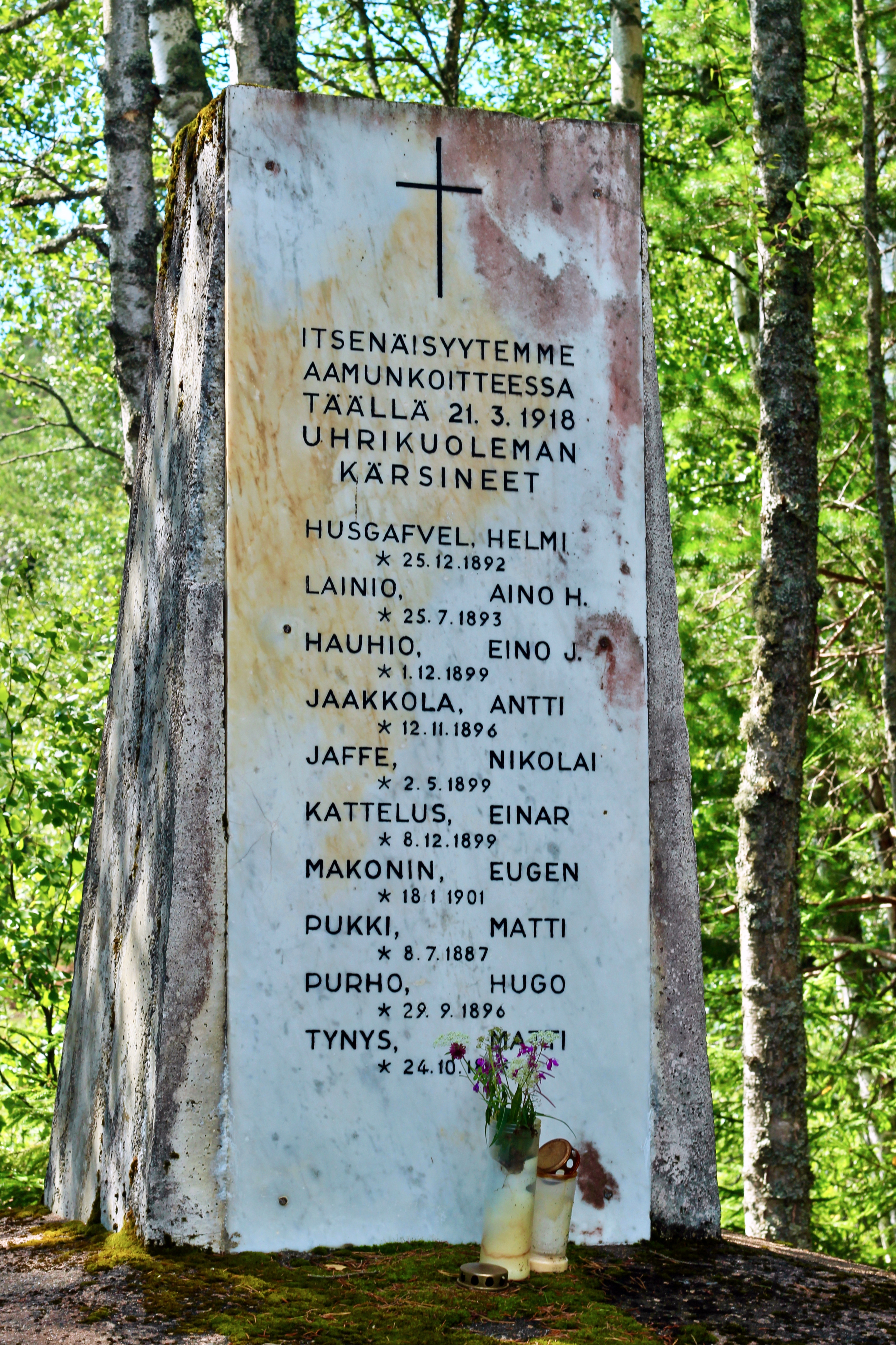
Huopaisenvirran muistomerkki on pystytetty vuoden 1918 sisällissodan tapahtumien muistolle. Luumäki oli lähes koko sodan ajan punaisten hallussa tärkeän rautatieyhteyden vuoksi. Sodan aikana Luumäen halki kulki kymmeniä pakolaisia rannikolta kohti pohjoista ja valkoista rintamaa. Maaliskuussa ryhmä haminalaisia nuoria oli pyrkimässä valkoisten puolelle ja heidät vangittiin Luumäellä. Aamulla vankeja lähdettiin kuljettamaan kahdella reellä Savitaipaleelle tutkittaviksi. Matkan varrella vangit, kaksi naista ja kahdeksan miestä, ammuttiin. Osa vainajista heitettiin Huopaisenvirran sillalta avoimeen virtaan.
The Huopaisenvirta monument
Huopaisenvirta and the monument are in many ways part of the history of Luumäki. The Väliväylä log floating route passed through Huopaisenvirta for about 70 years. The new bridge and the dam built at the mouth of the stream, as well as the lowering of the water surface of Lake Kivijärvi, have changed the landscape. The monument on the scene reminds us of the events of the early days of independent Finland a hundred years ago.
Väliväylä log floating route
The Väliväylä log floating route which passed through Huopaisenvirta is part of Finnish forest industry history. The Väliväylä floating route was opened for the transport of logs in the 1890s, and the 110 kilometers long route was in use for about seven decades. At the mouth of the Huopaisenvirta, the trees arrived as ferries surrounded by booms. The loads arriving from Ylä-Kivijärvi could have more than 16,000 logs each. The two-kilometer-long Huopaisenvirta was one of the problem areas of Väliväylä. The river was so narrow that it could not carry ferries, but on the other hand it was too wide that the flow did not carry trees properly. The height difference at Huopaisenvirta at that time was just over 40 cm. The rafts were demolished at the mouth of the Huopaisevirta and the trees were released into the stream. The trees were driven forward in the stream by booms that were attached to steel wires. At a narrow point in the stream, the flow was sufficient to transport the logs. Control booms were built on the sides of the stream to prevent the trees from getting stuck on the shores.
The flooding ended at the early 1960s because of the decline of the Kivijärvi water surface. Huopaisenvirta was dredged and a new bridge and regulation dam were built at the mouth of the stream. The water surface of Kivijärvi was lowered by more than 60 cm and the flow was considerably reduced. The floating structures have been demolished and the white-headed bubbling rapids during the spring floods are only living in the memories.
The log floating route was also used as a water barrier and fortification work was carried out north of the flouting route during the last wars. The fortification works in the watershed have been overshadowed by the more robust Salpaline and have not been fully mapped. Stone barriers and various trenches have been preserved best in the vicinity of the Väliväylä. The structures supported by the trees have rotted.
Monument
The Huopaisenvirta monument has been erected to commemorate the events of the 1918 Civil War. Luumäki was in the possession of the Reds for most of the war because of an important railway connection. During the war, dozens of refugees from the coast to the northern and White fronts passed through Luumäki. In March, a group of young people from Hamina were working towards the Whites and they were imprisoned in Luumäki. In the morning, the prisoners were transported on two sleighs to Savitaipale for investigation. Along the way, prisoners, two women and eight men, were shot. Some of the deceased were thrown into the river from the Huopaisenvirta bridge.
In English below.
Vuoden 2019 lokakuussa pystytettiin Hietamiehen kylään Jalkaväkirykmentti 16:n uusi muistomerkki kertomaan Luumäen alueella vuoden 1939 lopulla tehdyistä linnoitustöistä. Muistomerkin pystytti Pajarin Poikien Perinneyhdistys Ry yhdessä Luumäen kunnan ja muiden paikallisten toimijoiden kanssa. Muistomerkin yhteydessä on Leo Venäläisen tekemä puinen sotilasveistos sekä infotaulu. Paikalla on myös tilava parkkipaikka.
Jalkaväkirykmentti 16 perustettiin 13.–18.10.1939 Tampereella pääosin Pohjois-Hämeen reserviläisistä. Rykmentti kuului 6. Divisioonaan, joka sai tehtäväkseen ryhmittyä päämajan reserviksi Pulsa-Luumäki-Taavetti-Kaipiainen-Utti-alueelle. Rykementin komentajana toimi everstiluutnantti Aaro Pajari ja sen miesvahvuus oli noin 3000 sotilaista.
Perustamisen jälkeen rykmentti siirrettiin junakuljetuksin Taavetin asemalle. Täältä se majoittui aluksi rautatien eteläpuolelle Heimala-Luotola-Patolahti alueella. Lokakuun lopussa rykmentti siirtyi linnoitustöihin rautatien pohjoispuolelle Kivijärven ja Hietamiehen väliselle alueelle. Pääpaino linnoitustöillä oli panssariesteiden rakentamisella. Lisäksi rakennettiin asemat teiden kohdalle ja niihin konekiväärien asemia sekä ampumakuoppia ja taisteluhaudan pätkiä. Linnoitustöissä oli päivittäin noin kolmannes rykmentistä muiden ollessa erilaisissa koulutus- ja harjoitustapahtumissa.
Talvisodan sytyttyä rykmentti sai käskyn 5.12. siirtyä rautateitse Kaitjärven ja Taavetin asemilta Värtsilään ja sieltä edelleen marssien suoraan torjuntataisteluihin Osasto Talvelan osana Tolvajärvelle.
Muistomerkillä olevan päätaulun lisäksi kesäksi 2020 on tulossa maastoon linnoituskohteita esittelevät taulut ja ne muodostavat yhdessä Väliväylän uittoon liittyvien kohteiden kanssa noin 45 km reitin.
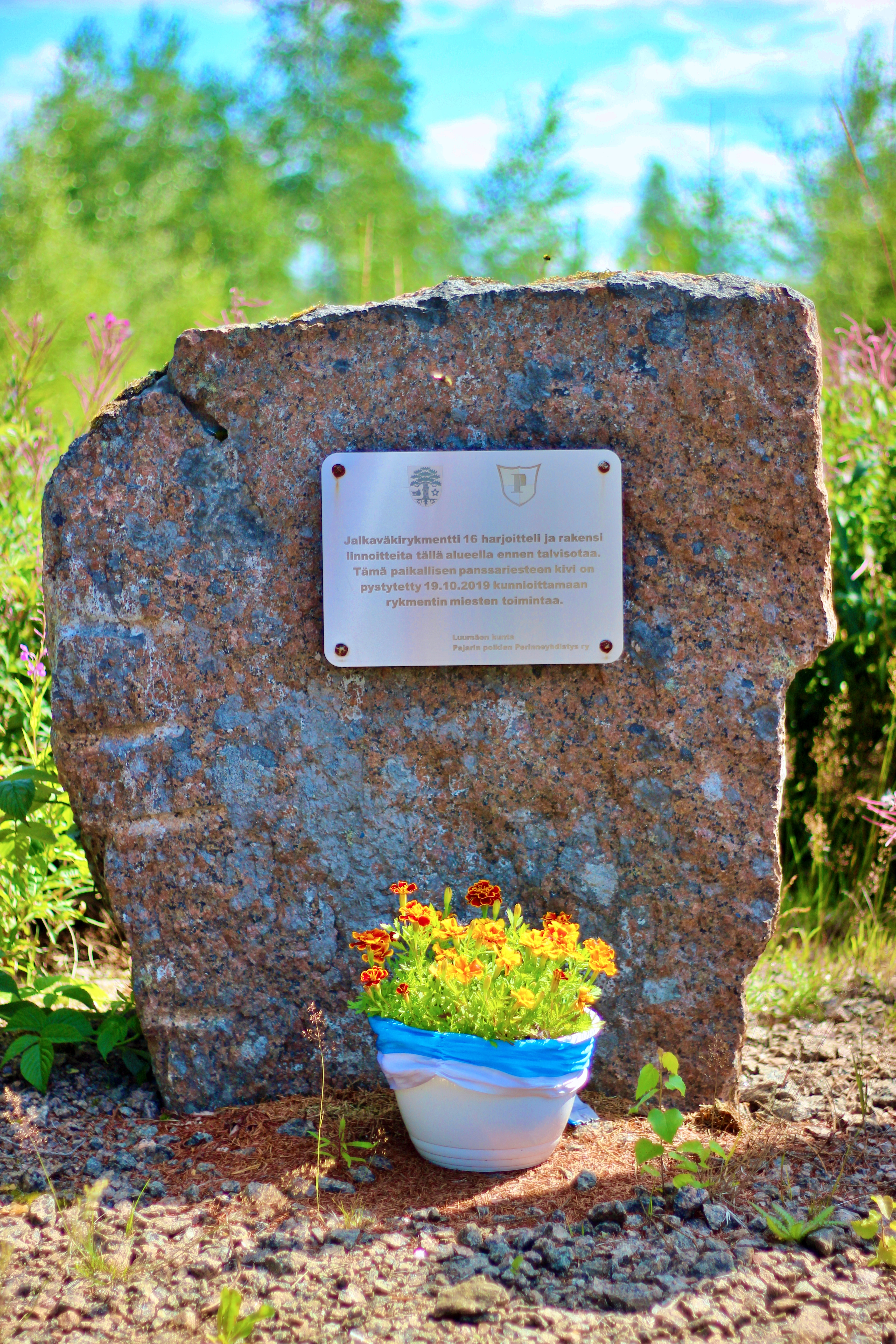
Monument of the Infantry Regiment 16
In October 2019, a new monument to the Infantry Regiment 16 was erected in the village of Hietamies to tell about the fortification work in the Luumäki area at the end of 1939. The monument was erected by the Pajarin Poikien Perinneyhdistys Ry association together with the municipality of Luumäki and other local operators. In connection with the monument, there is a wooden military sculpture by Leo Venäläinen and an information board. There is also a spacious car park.
The Infantry Regiment 16 was founded in Tampere between 14 and 18 October 1939, mainly by reservists from Northern Häme. Infantry Regiment 16 was part of the 6th Division, which was placed in the reserve of the military base. The regiment was commanded by Lieutenant Colonel Aaro Pajari and had a strength of about 3,000 soldiers.
After its establishment, the regiment was transferred by train to Taavetti station. From there it initially stayed south of the railway in the Heimala-Luotola-Patolahti area. At the turn of October and December, the regiment marched to the northern side of the railway and settled in the area between Lake Kivijärvi and the Village of Hietamies and started fortification work. The main emphasis in the fortification work was on the construction of armored barriers. In addition, stations were built on the roads, including machine gun stations and shooting ranges and battle grave fragments. There was about a third of the regiment in the fortification work every day, while the rest were in various training and rehearsal events.
After the start of the Winter War, the regiment received an order on December 5th to transfer by rail from Kaitjärvi and Taavetti stations to Värtsilä and from there onwards to direct combat battles as part of Department Talvela to Tolvajärvi.
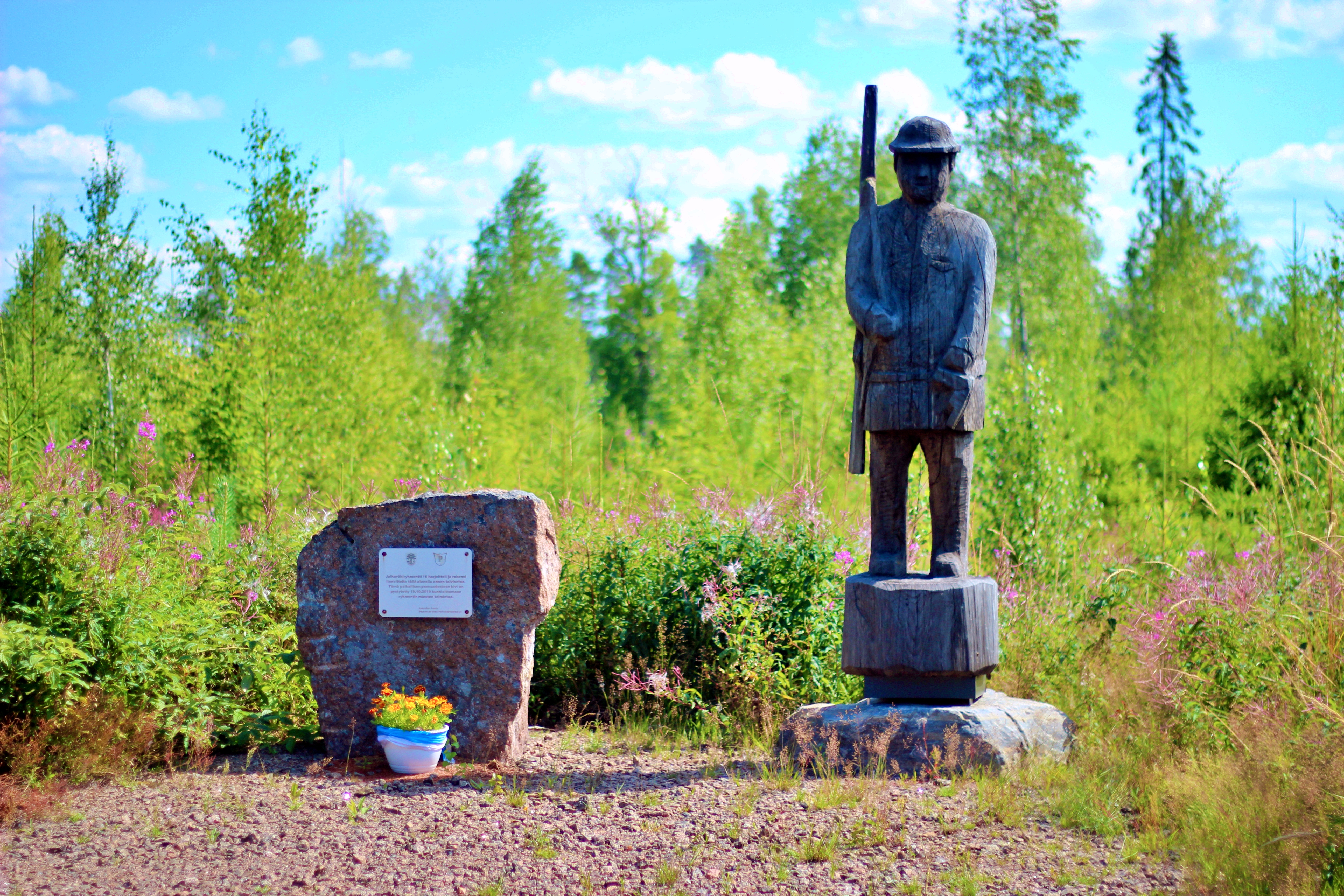
In English below.
Uudet Luumäen Itsenäisyydentien nähtävyyskohteet muodostavat Taavetin länsi- ja pohjoispuolelle noin 45 km pyöräilyreitin. Kaksi kohdetta on Huopaisenvirran vaellusreitillä. Kohteet kertovat II maailmasodan aikaisesta Hamina-Taavetti -linjasta, Jalkaväkirykmentti 16:n tekemistä linnoitteista ja esittelevät pätkän Väliväylää sekä kertovat sen tarinaa uittoreittinä ja viime sotien aikaisena vesiesteenä. Reitin voi kiertää haluamassaan suunnassa ja poimia matkan varrelta mielenkiintoisia paikkoja. Reittiä ei ole merkitty maastoon, katso tarkemmat sijannit kunkin kohteen kohdalta kartan alta. Matkan varrella voi Huopaisenvirran laavulla nauttia eväitä ja hetken hengähtää.
Huomioithan liikkuessasi muun liikenteen ja pysähdy turvalliseen paikkaan, pienemmillä teillä kulkee myös raskasta liikennettä. Autoille ei ole erikseen merkitty parkkipaikkoja kaikissa kohteissa. Pyörällä liikkuessasi huomioi, ettei Taavetin länsipuolella ole pyörätietä Vt6:n laidalla. Numeroilla merkityissä kohteissa on isot opastustaulut, kirjaimilla merkityissä pienet opastustaulut. Ruskealla värillä on merkitty JR 16:n kohteet.
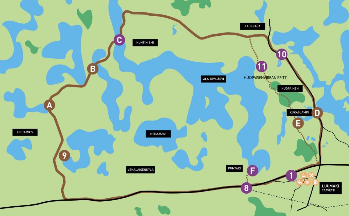
1. Taavetin linnoitus
1700-luvun Taavetin linnoituksella on oma esittelysivunsa, tutustu täältä.
8. Itsenäsyydentien infotaulu, joka esittelee lisäksi Hamina-Taavetti -linjan
Taavetin länsipuolen levähdysalueilla sekä Haminaan johtavan Vt26 levähdysalueella on infotaulut, jotka kertovat sekä Itsenäisyydentiestä sekä Hamina-Taavetti -linjasta. Tätä puolustuslinjaan rakennettiin samanaikaisesti Salpalinjan kanssa viime sotien aikaan. Hamina-Taavetti -linja jäi kesken, mutta siitä on edelleen paljon maastossa näkyvillä. Linjan rakenteita on edelleen nähtävillä maastossa useassa paikassa. Levähdysalueen kohta oli tärkeä linnoituskohta, koska tässä kulkivat sekä rautatie ja maantie rinnakkain.
F. Puntarin louhos
Hamina-Taavetti -linjan rakennetun osuuden päätepiste on Puntarin Aitlahdessa, jonne ehdittiin louhia valmiiksi paikat ase- ja majoituskorsuja varten. Pyöräillen tai kävellen paikalle pääsee suoraan Vt6:n levähdysalueelta ja matkalla varrella näkee tehtyjä kaivantoja. Matkaa on reilu kilometri Ala-Kivijärven suuntaan. Autolla kulku Kelveläntien kautta.
9. JR 16 muistomerkki
JR 16 muistomerkillä on oma esittelysivunsa, tutustu täältä. Maastossa olevia linnoitustöitä esitteleviä alakohteita on neljä.
A. JR 16 Hietamies
Tämän alueen linnoitteet on tehnyt marraskuussa 1939 II Pataljoona. Nähtävissä on edelleen lohkotuista kivistä tehdyt esteet sekä suokaivannot. Linnoitteita on Hietamiehentien molemmin puolin.
B. JR 16 Ruunalampi
Tämän alueen linnoitteet on tehnyt marraskuussa 1939 I Pataljoona. Nähtävissä on Ruunalammen suuntaan leveää suokaivantoa ja lyhyt pätkä kiviestettä Hiijärveen.
C. Salmin silta
Tällä kohtaa kulki Väliväylän uittoreitti ja paikalla oli uiton aikaan kaareva puusilta, jonka alta uittoalukset mahtuivat hinaamaan lauttoja. Sillan itäpuolella on havaittavissa maastoutuneita kaivantoja. Niiden tekoajan kohdasta ei ole varmuutta, mutta ne liittyvät puolustukseen ja Väliväylän käyttöön vesiesteenä. Opastustaulu on sillan itäpuolella ylempänä maastossa. Sillalla liikkuu myös rakasta liikennettä. Huomiothan se liikkuessasi.
11. Huopaisenvirran laavu
Huopaisenvirran laavulla on oma esittelysivunsa, tutustu täältä.
E. JR 16 Kukaslampi
Tämä alueen linnoitteet on tehnyt marraskuussa 1939 III Pataljoona. Nähtävissä on Raatjärvenlahden ja Kukaslammen väliselle kannakselle kaivettu panssari- eli suokaivantoa, joka erottuu maastossa leveänä siksak-mallisena ojana. Paikalle etelästä tultaessa Raitalantieltä on noin 200 metriä matkaa vaellusreitinpolkuraa pohjoiseen.
10. Huopaisenvirran muistomerkki
Huopaisenvirran muistomerkillä on oma esittelusivunsa, tutustu täältä.
D. JR 16 Perälä
Tämän alueen linnoitteet on tehnyt III Pataljoona, joka rakensi kiviestettä Kivijärven ja Kukaslammen väliselle kannakselle. Tuolloin rakennetut esteet olivat huomattavasti matalampia kuin Salpalinjalla. Kulku kohteelle veneenlaskupaikan kautta.
“Fortification work and log floating” route
The new attractions of Luumäki Itsenäisyydentie road form a 45 kilometers long cycling route to the west and north of Taavetti. There are two destinations on the Huopaisenvirta hiking trail. The sites tell the story of the Hamina-Taavetti line during World War II, the fortifications made by the Infantry Regiment 16 and present a section of the Väliväylä, as well as its story as a timber rafting route and a water barrier during the last wars. You can get around the route in the direction you want and pick up places of interest along the way. The route is not marked on the terrain, you can see more detailed locations for each destination under the map. Along the way, you can enjoy snacks and rest for a while in the Huopaisenvirta lean-to.
When cycling, please pay attention to other traffic on the route and only stop in a safe place, on smaller roads there is also heavy traffic. There are no separate parking spaces for cars at all locations. As you ride your bike, note that there is no bike path on the west side of Highway 6 on the west side of Taavetti. Attractions marked with numbers have large information boards, and attractions marked with letters have smaller information boards.

1. Taavetti Fortress
The 18th century Taavetti Fortress has its own introduction page, check it out here.
8. The Itsenäisyydentie road information board, which also presents the Hamina-Taavetti line
There are information boards in the rest areas on the west side of Taaveti and in the rest areas of Highway 26 leading to Hamina, which tell about both the Itsenäisyydentie road and the Hamina-Taavetti line. This line of defense was built at the same time as Salpaline during the last wars. The Hamina-Taavetti line was interrupted, but much of it is still visible in the terrain. The resting area was an important fortification point, as both the railway and the road ran side by side here.
F. Puntari quarry
The end point of the built section of the Hamina-Taavetti line is in Puntari's Aitlahti, where the sites for weapons and accommodation dugouts were excavated. By bike or on foot, you can get to the quarry directly from the rest area of Highway 6 and along the way you can see the ditches made. The distance is just over a kilometer in the direction of Ala-Kivijärvi. By car via Kelveläntie.
9. Infantry Regiment 16 monument
The Infantry Regiment of 16 Monuments has its own presentation page, check it out here. There are four sub-sites presenting fortification work in the terrain.
A. Infantry Regiment 16 Hietamies
The fortifications of this area were made in November 1939 by the 2nd Battalion. Obstacles made of blocked stones and swamp ditches can still be seen. There are fortifications on both sides of Hietamiehentie.
B. Infantry Regiment 16 Ruunalampi
The fortifications of this area were made in November 1939 by the 1st Battalion. You can see a wide swamp in the direction of Ruunalampi and a short section of rock in Hiijärvi.
C. Salmi bridge
At this point, the log floating route of the Väliväylä passed and there was a curved wooden bridge at the time. Under the bridge there passed ships towing log ferries. To the east of the bridge are noticeable trenches that have been terrained. There is no certainty as to when they will be made, but they relate to defense and the use of the Väliväylä as a water barrier. The information board is on the east side of the bridge higher up in the terrain. The bridge also has beloved traffic. Please note this when moving around the area.
11. Huopaisenvirta lean-to
Huopaisenvirta lean-to has its own presentation page, check it out here.
E. Infantry Regiment 16 Kukaslampi
The fortress of this area was made in November 1939 by the 3rd Battalion. An armored trench dug on the isthmus between Raatjärvenlahti and Kukaslampi can be seen, which stands out in the terrain as a wide zigzag-shaped ditch. Coming from the south from Raitalantie, there is about a 200-meter hiking trail to the north.
10. Huopaisenvirta monument
Huopaisenvirta monument has its own presentation page, check it out here.
D. Infantry Regiment 16 Perälä
The fortifications of this area have been made by the 3rd Battalion, which built a stone barrier on the isthmus between Kivijärvi and Kukaslampi. The barriers built at that time were considerably lower than on the Salpa line. Access to the destination via the boat landing place.
In English below.
Itsenäisyydentiellä on kaksi infopistettä ja kesäksi 2020 on valmistunut Vt6 levähdysalueille Taavetin länsipuolelle sekä Vt26 Taavetin eteläpuolelle pienet infotaulut, jotka kertovat lyhyesti Itsenäisyydentiestä ja paikalla suunnitellusta ja osin rakennetusta viime sotien aikaisesta Hamina-Taavetti - puolustuslinjasta.
Piha-alueella on esillä koko Itsenäisyydentietä esittelevät infotaulut. Sisätiloissa on jaossa esitteitä sekä lisätietoa lähialueen kohteista.
Läntinen infopiste sijaitsee Satun Makioilla Rantsilanmäellä valtatien tuntumassa, osoitteessa Urontie 1, opasteet Vt6:lta. Muutaman kilometrin päässä sijaitsevat ovat Luumäen kirkonmäki ja Taavetin linnoitus.
Itäinen infopiste sijaitsee Kahvi-Pakarilla Jurvalassa, osoitteessa Saarentie 1, opasteet Itsenäisyydentieltä. Lähistöllä on muun muassa Salpalinjan kohteita ja Kotkaniemi.
Infopisteissä voit suunnitella eri kohteisiin tutustumista, nauttia kahvista tai lounaasta. Herkkuja löytyy myös matkaevääksi tai tuliaiseksi. Tilaa riittää isommallekin joukolle.
Tutustu infopisteiden päivittäiseen tarjontaan, muihin palveluihin sekä aukioloaikoihin niiden omilta kotisivuilta ja Facebookista.
www.satunmakiat.fi ja www.kahvipakari.fi
- Itsenäisyydentien läntinen infopiste ja kahvila Satun Makiat
- Itsenäisyydentie itäinen infopiste ja Kahvi-Pakari
Information points
There are two information points on Itsenäisyydentie road and by summer 2020 small information boards for Highway 6 to the west of Taavetti and Highway 26 south of Taavetti was completed, giving a brief overview of Itsenäisyydentie road and the Hamina-Taavetti line of defense planned and partly built on site.
Information boards presenting the entire Itsenäisyydentie road are on display in the courtyard area. Indoors, brochures and information on nearby properties are available.
The western information point is in Satun Makiat on Rantsilanmäki near the Highway, at Urontie 1, signs from Highway 6. A few kilometers away are Luumäki Church Hill and Taavetti Fortress.
The eastern information point is in Kahvi-Pakari in Jurvala, at Saarentie 1, signs from Itsenäisyydentie road. Nearby points of interest also include Salpa line and Kotkaniemi.
At the information points you can plan to explore different destinations, enjoy a coffee or lunch. Delicacies can also be found for travel or as a gift. There is also enough space for a larger group.
Check out the daily offer of the information points, other services and opening hours on their own websites and Facebook.


